Author: Admiralty
Title: Nautical Chart No. 2961 Barents Sea - Russia, Pechorskaya Guba
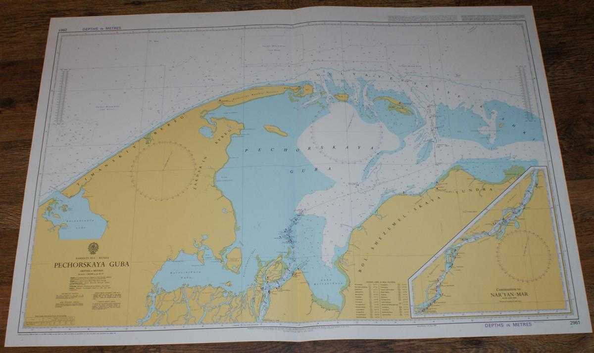
Description: Admiralty, 2005. Revised Edition, Softcover. Very Good Condition/No Dust Jacket. Crisp and clean colour chart with single vertical fold. Very small crease in bottom right hand margin and slight wear to vertical margins. Nautical Chart No. 2961 Barents Sea - Russia, Pechorskaya Guba. Copyright 1985 with small corrections to 2005. Scale 1:200,000. Sheet contains inset at same scale of 'Continuation to Nar'yan-Mar'. Area Covered: Russia (part), Timanskiy Bereg, Zakhar'in Bereg, Poluostrov Russkiy Zavorot, Bol'shezemel'skaya Tundra. Barents Sea (part), Pechorskaya Guba, Kolokolkova Guba, Korovinskaya Guba, Guba Bolvanskaya, Gulyayevskiye Koshki, Reka Pechora. Size: 72x104. Single sheet map/chart which is suitable for framing and will be shipped rolled and in a cardboard tube. Quantity Available: 1. Shipped Weight: under 1 kg. Pictures of this item not already displayed here available upon request. Inventory No: 45517114054. ISBN: 0195123824
Keywords: BZDB4 Maps; Russia & Eastern Europe; Arctic & Antarctic; naval, naval history, maritime, ships, boats. Admiralty Nautical Chart No. 2961 Barents Sea - Russia, Pechorskaya Guba Russia & Eastern Europe Arctic & Antarctic naval, naval history, maritime, shi
See more books from our catalog: Maps
Title: Nautical Chart No. 2961 Barents Sea - Russia, Pechorskaya Guba
Description: Admiralty, 2005. Revised Edition, Softcover. Very Good Condition/No Dust Jacket. Crisp and clean colour chart with single vertical fold. Very small crease in bottom right hand margin and slight wear to vertical margins. Nautical Chart No. 2961 Barents Sea - Russia, Pechorskaya Guba. Copyright 1985 with small corrections to 2005. Scale 1:200,000. Sheet contains inset at same scale of 'Continuation to Nar'yan-Mar'. Area Covered: Russia (part), Timanskiy Bereg, Zakhar'in Bereg, Poluostrov Russkiy Zavorot, Bol'shezemel'skaya Tundra. Barents Sea (part), Pechorskaya Guba, Kolokolkova Guba, Korovinskaya Guba, Guba Bolvanskaya, Gulyayevskiye Koshki, Reka Pechora. Size: 72x104. Single sheet map/chart which is suitable for framing and will be shipped rolled and in a cardboard tube. Quantity Available: 1. Shipped Weight: under 1 kg. Pictures of this item not already displayed here available upon request. Inventory No: 45517114054. ISBN: 0195123824
Keywords: BZDB4 Maps; Russia & Eastern Europe; Arctic & Antarctic; naval, naval history, maritime, ships, boats. Admiralty Nautical Chart No. 2961 Barents Sea - Russia, Pechorskaya Guba Russia & Eastern Europe Arctic & Antarctic naval, naval history, maritime, shi
Price: GBP 24.00 = appr. US$ 34.27 Seller: Bailgate Books Ltd
- Book number: 45517114054
- Book number: 45517114054
See more books from our catalog: Maps