Author: Admiralty
Title: Nautical Chart No. AUS 399 South Pacific Ocean - Bougainville Island
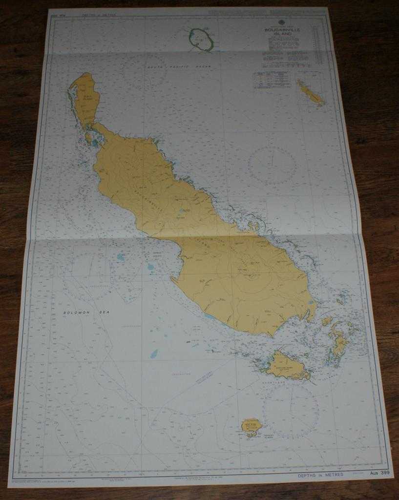
Description: Map Admiralty, 2005. Revised Edition, Softcover. Very Good Condition/No Dust Jacket. Crisp and clean colour chart with two horizontal folds. Nautical Chart No. AUS 399 South Pacific Ocean - Bougainville Island. Copyright 1999 with small corrections to 2005. Scale 1:300,000. Area Covered: Bougainville Island, Empire Range, Crown Prince Range, Buka Island, Shortland Islands, Treasury Islands, Shortland Island, Mono Island, Fauro Island, Ovau Island, Tulun (Carteret) Islands. South Pacific Ocean, Solomon Sea, Empress Augusta Bay, Tulun Lagoon, Buka Passage. Item Type: Map. Quantity Available: 1. Shipped Weight: under 1 kg. Pictures of this item not already displayed here available upon request. Inventory No: 45517084041. ISBN: 1859831060
Keywords: BZDB4 Maps; naval, naval history, maritime, ships, boats; Australasia and the Pacific. Admiralty Nautical Chart No. AUS 399 South Pacific Ocean - Bougainville Island naval, naval history, maritime, ships, boats Australasia and the Pacific
See more books from our catalog: Maps
Title: Nautical Chart No. AUS 399 South Pacific Ocean - Bougainville Island
Description: Map Admiralty, 2005. Revised Edition, Softcover. Very Good Condition/No Dust Jacket. Crisp and clean colour chart with two horizontal folds. Nautical Chart No. AUS 399 South Pacific Ocean - Bougainville Island. Copyright 1999 with small corrections to 2005. Scale 1:300,000. Area Covered: Bougainville Island, Empire Range, Crown Prince Range, Buka Island, Shortland Islands, Treasury Islands, Shortland Island, Mono Island, Fauro Island, Ovau Island, Tulun (Carteret) Islands. South Pacific Ocean, Solomon Sea, Empress Augusta Bay, Tulun Lagoon, Buka Passage. Item Type: Map. Quantity Available: 1. Shipped Weight: under 1 kg. Pictures of this item not already displayed here available upon request. Inventory No: 45517084041. ISBN: 1859831060
Keywords: BZDB4 Maps; naval, naval history, maritime, ships, boats; Australasia and the Pacific. Admiralty Nautical Chart No. AUS 399 South Pacific Ocean - Bougainville Island naval, naval history, maritime, ships, boats Australasia and the Pacific
Price: GBP 26.00 = appr. US$ 37.13 Seller: Bailgate Books Ltd
- Book number: 45517084041
- Book number: 45517084041
See more books from our catalog: Maps