Author: Admiralty
Title: Nautical Chart No. 1805 Mediterranean, France - South Coast, Sete to Marseille
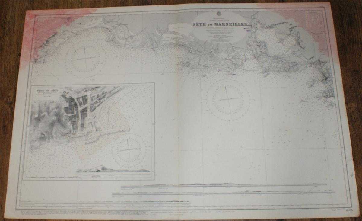
Description: Admiralty, 1962. Revised Edition, Softcover. Good Condition/No Dust Jacket. Black and white chart with single vertical fold. Edges are worn and a little darkened. Some annotation. Top left and right hand corners of sheet are marked with red stained patches which extend into mapped area. Two parts of map have been overlayed with well fitted cut-out sections of sheet. Nautical Chart No. 1805 Mediterranean, France - South Coast, Sete to Marseille. New edition 1914 with small corrections to 1953 and further hand penned small corrections to 1962. Scale 1:146,000 Sheet contains inset plan of Port of Sete at scale 1: 12,700 and four engraved long-section coastal views Area Covered: France (part), Sete, Montpellier, Mauguio, Auges-Mortes, Ile du Plan du Bourg, Marseille, Pomegues Island, Riou Island Etang de Palavas, Etang de Mauguio, Etang du Valcares, River Rhone, Gulf of Saintes Maries, Etang de Berre, Gulf of Foz Size: 71x103cm. Quantity Available: 1. Shipped Weight: under 1 kg. Pictures of this item not already displayed here available upon request. Inventory No: 45517034058. ISBN: 090019720X
Keywords: BZDB4 Maps; France and French Language; naval, naval history, maritime, ships, boats. Admiralty Nautical Chart No. 1805 Mediterranean, France - South Coast, Sete to Marseille France and French Language naval, naval history, maritime, ships, boats
See more books from our catalog: Maps
Title: Nautical Chart No. 1805 Mediterranean, France - South Coast, Sete to Marseille
Description: Admiralty, 1962. Revised Edition, Softcover. Good Condition/No Dust Jacket. Black and white chart with single vertical fold. Edges are worn and a little darkened. Some annotation. Top left and right hand corners of sheet are marked with red stained patches which extend into mapped area. Two parts of map have been overlayed with well fitted cut-out sections of sheet. Nautical Chart No. 1805 Mediterranean, France - South Coast, Sete to Marseille. New edition 1914 with small corrections to 1953 and further hand penned small corrections to 1962. Scale 1:146,000 Sheet contains inset plan of Port of Sete at scale 1: 12,700 and four engraved long-section coastal views Area Covered: France (part), Sete, Montpellier, Mauguio, Auges-Mortes, Ile du Plan du Bourg, Marseille, Pomegues Island, Riou Island Etang de Palavas, Etang de Mauguio, Etang du Valcares, River Rhone, Gulf of Saintes Maries, Etang de Berre, Gulf of Foz Size: 71x103cm. Quantity Available: 1. Shipped Weight: under 1 kg. Pictures of this item not already displayed here available upon request. Inventory No: 45517034058. ISBN: 090019720X
Keywords: BZDB4 Maps; France and French Language; naval, naval history, maritime, ships, boats. Admiralty Nautical Chart No. 1805 Mediterranean, France - South Coast, Sete to Marseille France and French Language naval, naval history, maritime, ships, boats
Price: GBP 24.00 = appr. US$ 34.27 Seller: Bailgate Books Ltd
- Book number: 45517034058
- Book number: 45517034058
See more books from our catalog: Maps