Author: Admiralty
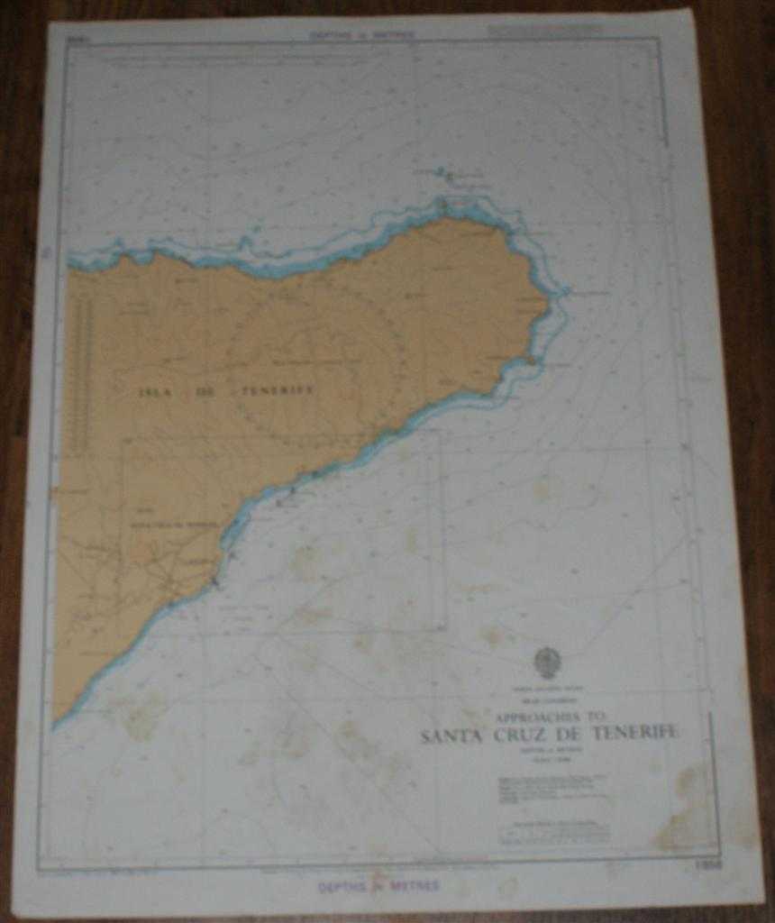
Title: Nautical Chart No. 1858 North Atlantic Ocean - Islas Canarias, Approaches to Santa Cruz de Tenerife
Description: Map Admiralty, 1985. Revised Edition, Softcover. Fair Condition/No Dust Jacket. Colour chart with no formal fold. Sheet is marked and stained with some light creasing. Edges are a little rubbed and worn. Nautical Chart No. 1858 North Atlantic Ocean - Islas Canarias, Approaches to Santa Cruz de Tenerife. Copyright 1979 with small corrections to 1985. Scale 1:50,000 Area Covered: Isla de Tenerife (part), Santa Cruz de Tenerife, La Cuesta, Punta de las Coloradas, Roques de Anaga, Las Carboneras, Punta Fajana Size: 71x52cm. Item Type: Map. No dust jacket, as published. Single sheet map/chart which is suitable for framing and will be shipped rolled and in a cardboard tube.. Quantity Available: 1. Shipped Weight: under 1 kg. Pictures of this item not already displayed here available upon request. Inventory No: 45517021409. ISBN: 0002116448
Keywords: BZDB4 Maps; Spain and Portugal, Spanish & Portuguese Language; naval, naval history, maritime, ships, boats. Admiralty Nautical Chart No. 1858 North Atlantic Ocean - Islas Canarias, Approaches to Santa Cruz de Tenerife Spain and Portugal, Spanish & Portug
See more books from our catalog: Maps
Title: Nautical Chart No. 1858 North Atlantic Ocean - Islas Canarias, Approaches to Santa Cruz de Tenerife
Description: Map Admiralty, 1985. Revised Edition, Softcover. Fair Condition/No Dust Jacket. Colour chart with no formal fold. Sheet is marked and stained with some light creasing. Edges are a little rubbed and worn. Nautical Chart No. 1858 North Atlantic Ocean - Islas Canarias, Approaches to Santa Cruz de Tenerife. Copyright 1979 with small corrections to 1985. Scale 1:50,000 Area Covered: Isla de Tenerife (part), Santa Cruz de Tenerife, La Cuesta, Punta de las Coloradas, Roques de Anaga, Las Carboneras, Punta Fajana Size: 71x52cm. Item Type: Map. No dust jacket, as published. Single sheet map/chart which is suitable for framing and will be shipped rolled and in a cardboard tube.. Quantity Available: 1. Shipped Weight: under 1 kg. Pictures of this item not already displayed here available upon request. Inventory No: 45517021409. ISBN: 0002116448
Keywords: BZDB4 Maps; Spain and Portugal, Spanish & Portuguese Language; naval, naval history, maritime, ships, boats. Admiralty Nautical Chart No. 1858 North Atlantic Ocean - Islas Canarias, Approaches to Santa Cruz de Tenerife Spain and Portugal, Spanish & Portug
Price: GBP 16.00 = appr. US$ 22.85 Seller: Bailgate Books Ltd
- Book number: 45517021409
- Book number: 45517021409
See more books from our catalog: Maps