Author: Admiralty
Title: Nautical Chart No. L(D1)1076 Wales - South Coast, Linney Head to Oxwich Point
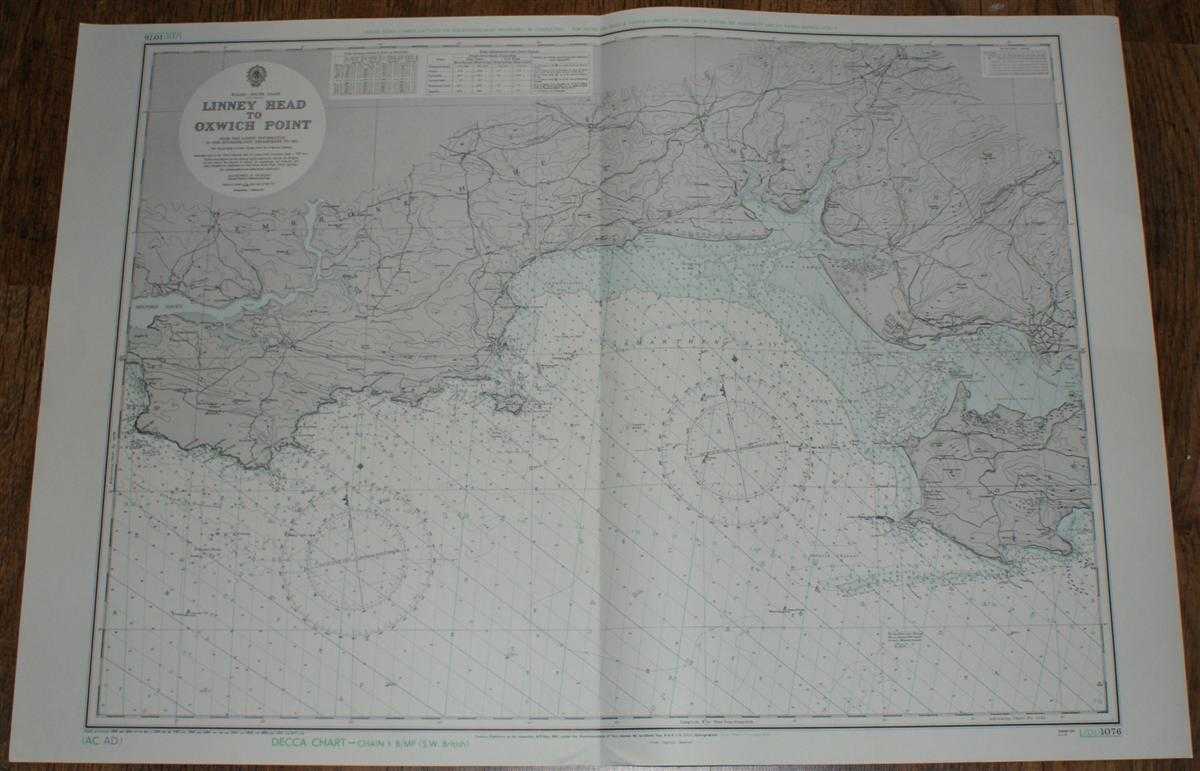
Description: Map Admiralty, 1973. Revised Edition, Softcover. Very Good Condition/No Dust Jacket. Clean and crisp coloured chart with AC and AD Decca lines. Single vertical fold. Nautical Chart No. L(D1)1076 Wales - South Coast, Linney Head to Oxwich Point. Small corrections to 1973. Area Covered: Wales (part), Pembrokeshire (part), Carmarthenshire (part), Gower (part), Caldy I. Llanelly, Tenby Carmarthen Bay, Milford Haven, Saundersfoot Bay, Cefn Sidan Sands, Burry Inlet, Helwick Channel, R. Taf, R. Tywi, R. Cleddau Size: 71x103cm. Item Type: Map. No dust jacket, as published. Single sheet map/chart which is suitable for framing and will be shipped rolled and in a cardboard tube.. Quantity Available: 1. Shipped Weight: under 1 kg. Pictures of this item not already displayed here available upon request. Inventory No: 45517011308. ISBN: 0952054531
Keywords: BZDB4 Nautical chart, map, shipping Maps; Wales and Welsh History, literature & language; naval, naval history, maritime, ships, boats. Admiralty Nautical Chart No. L(D1)1076 Wales - South Coast, Linney Head to Oxwich Point Wales and Welsh History, litera
See more books from our catalog: Maps
Title: Nautical Chart No. L(D1)1076 Wales - South Coast, Linney Head to Oxwich Point
Description: Map Admiralty, 1973. Revised Edition, Softcover. Very Good Condition/No Dust Jacket. Clean and crisp coloured chart with AC and AD Decca lines. Single vertical fold. Nautical Chart No. L(D1)1076 Wales - South Coast, Linney Head to Oxwich Point. Small corrections to 1973. Area Covered: Wales (part), Pembrokeshire (part), Carmarthenshire (part), Gower (part), Caldy I. Llanelly, Tenby Carmarthen Bay, Milford Haven, Saundersfoot Bay, Cefn Sidan Sands, Burry Inlet, Helwick Channel, R. Taf, R. Tywi, R. Cleddau Size: 71x103cm. Item Type: Map. No dust jacket, as published. Single sheet map/chart which is suitable for framing and will be shipped rolled and in a cardboard tube.. Quantity Available: 1. Shipped Weight: under 1 kg. Pictures of this item not already displayed here available upon request. Inventory No: 45517011308. ISBN: 0952054531
Keywords: BZDB4 Nautical chart, map, shipping Maps; Wales and Welsh History, literature & language; naval, naval history, maritime, ships, boats. Admiralty Nautical Chart No. L(D1)1076 Wales - South Coast, Linney Head to Oxwich Point Wales and Welsh History, litera
Price: GBP 25.00 = appr. US$ 35.70 Seller: Bailgate Books Ltd
- Book number: 45517011308
- Book number: 45517011308
See more books from our catalog: Maps