Author: Admiralty
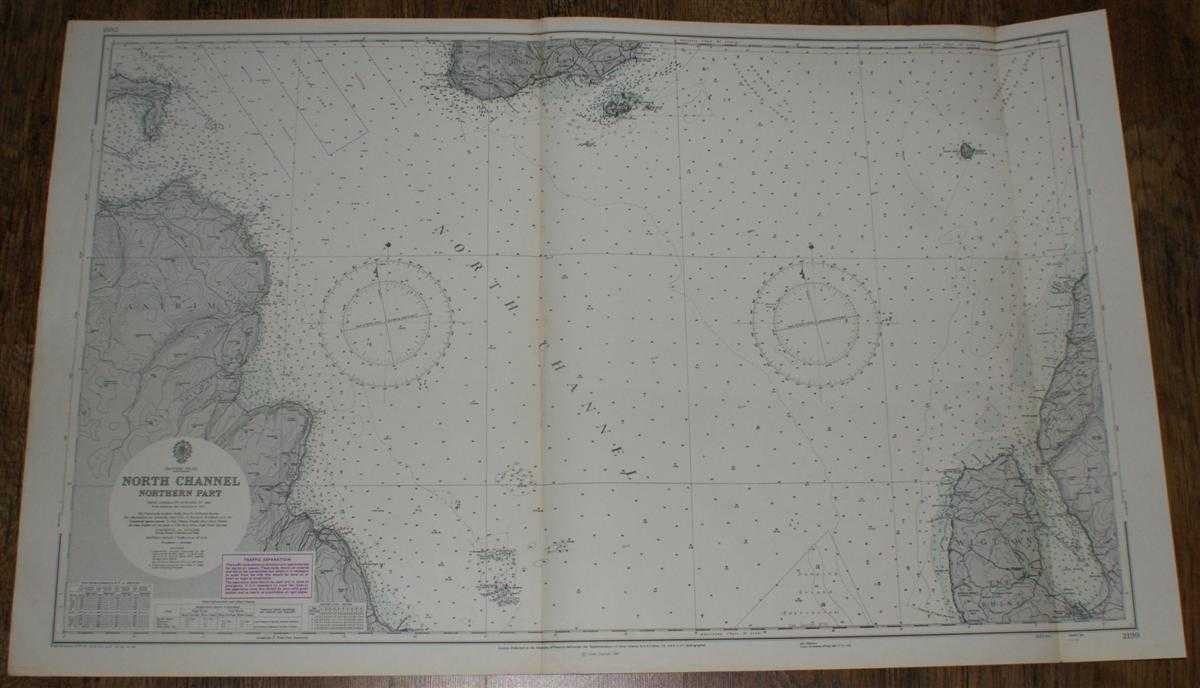
Title: Nautical Chart No. 2199: British Isles - North Channel, Northern Part. From Admiralty surveys to 1964. Additions and corrections to 1965. Scale 1:75,000.
Description: Map Admiralty, London, 1973. Revised Edition, Softcover. Very Good Condition/No Dust Jacket. Nautical Chart No. 2199: British Isles - North Channel, Northern Part. From Admiralty surveys to 1964. Additions and corrections to 1965. Large corrections to 1968. Small Corrections to 1973. Scale 1:75,000. Clean coloured chart. Two vertical folds. Slight creasing on lower edge in margin. Slightly darkened and lightly marked on reverse. Slightly darkened along on front along main fold. Area covered: Antrim (part), Rathlin Island, Argyll (part), Sanda Island, Ayr (part), Wigtown, The Rhins (part), Elsa Craig, East and West Maiden, The Mull of Kintyre, Ballycastle, Runabay, Cushendun, Cushendall, Leswalt, Stranraer (part); North Channel, Entrance to Kilbrannan Sound, Entrance to the Firth of Clyde, Sanda Sound, Rathlin Sound, Church Bay, Red Bay, Ballantrae Bay, Loch Ryan, Size: 1130mm by 710mm. Item Type: Map. No dust jacket, as published. Single sheet map/chart which is suitable for framing and will be shipped rolled and in a cardboard tube.. Quantity Available: 1. Shipped Weight: under 1 kg. Pictures of this item not already displayed here available upon request. Inventory No: 45516111122. ISBN: 0952632322
Keywords: BZDB4 , nautical chart, shipping Maps; Ireland; Scotland; naval, naval history, maritime, ships, boats. Admiralty Nautical Chart No. 2199: British Isles - North Channel, Northern Part. From Admiralty surveys to 1964. Additions and corrections to 1965. Sca
See more books from our catalog: Maps
Title: Nautical Chart No. 2199: British Isles - North Channel, Northern Part. From Admiralty surveys to 1964. Additions and corrections to 1965. Scale 1:75,000.
Description: Map Admiralty, London, 1973. Revised Edition, Softcover. Very Good Condition/No Dust Jacket. Nautical Chart No. 2199: British Isles - North Channel, Northern Part. From Admiralty surveys to 1964. Additions and corrections to 1965. Large corrections to 1968. Small Corrections to 1973. Scale 1:75,000. Clean coloured chart. Two vertical folds. Slight creasing on lower edge in margin. Slightly darkened and lightly marked on reverse. Slightly darkened along on front along main fold. Area covered: Antrim (part), Rathlin Island, Argyll (part), Sanda Island, Ayr (part), Wigtown, The Rhins (part), Elsa Craig, East and West Maiden, The Mull of Kintyre, Ballycastle, Runabay, Cushendun, Cushendall, Leswalt, Stranraer (part); North Channel, Entrance to Kilbrannan Sound, Entrance to the Firth of Clyde, Sanda Sound, Rathlin Sound, Church Bay, Red Bay, Ballantrae Bay, Loch Ryan, Size: 1130mm by 710mm. Item Type: Map. No dust jacket, as published. Single sheet map/chart which is suitable for framing and will be shipped rolled and in a cardboard tube.. Quantity Available: 1. Shipped Weight: under 1 kg. Pictures of this item not already displayed here available upon request. Inventory No: 45516111122. ISBN: 0952632322
Keywords: BZDB4 , nautical chart, shipping Maps; Ireland; Scotland; naval, naval history, maritime, ships, boats. Admiralty Nautical Chart No. 2199: British Isles - North Channel, Northern Part. From Admiralty surveys to 1964. Additions and corrections to 1965. Sca
Price: GBP 24.00 = appr. US$ 34.27 Seller: Bailgate Books Ltd
- Book number: 45516111122
- Book number: 45516111122
See more books from our catalog: Maps