Author: Admiralty
Title: Nautical Chart No. 2116. Denmark and Germany. Entrance To The Baltic, Little Belt and Kieler Bucht. Scale 1:150,000
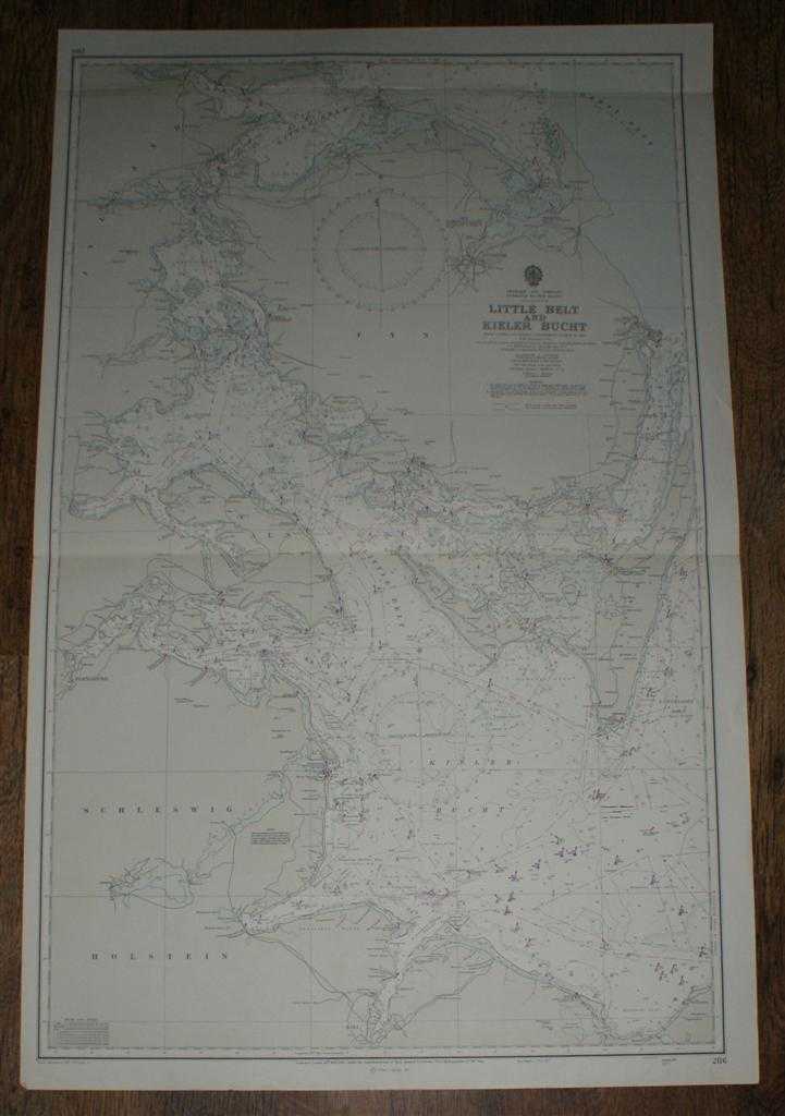
Description: Map Admiralty, London, 1973. Revised Edition, Softcover. Very Good Condition/No Dust Jacket. Crisp clean coloured chart. Two horizontal folds, two small inked stamps on reverse. Nautical Chart No. 2116. Denmark and Germany. Entrance To The Baltic, Little Belt and Kieler Bucht. Scale 1:150,000 Compiled from Danish and Swedish Government Charts to 1960, With, large corrections to 1972, small corrections to 1973, Area covered: Schleswig Holstein, Kiel, Flensburg, Kegnaes, Fakkebjerg, Ero, Langelands, Kieler Bucht, Als, Aabenraa, Hadersley, Aaro, Brandso, Kolding, Fredericia, Helnaes, Bogense, Hindsholm, Skoven, Odense, Nyborg, Svendborg, Horne Land. Size: 1110mm x 710mm. Item Type: Map. No dust jacket, as published. Single sheet map/chart which is suitable for framing and will be shipped rolled and in a cardboard tube.. Quantity Available: 1. Shipped Weight: under 1 kg. Pictures of this item not already displayed here available upon request. Inventory No: 45516111016. ISBN: 0948265795
Keywords: BZDB4 nautical chart, shipping, Maps; Scandinavia; naval, naval history, maritime, ships, boats. Admiralty Nautical Chart No. 2116. Denmark and Germany. Entrance To The Baltic, Little Belt and Kieler Bucht. Scale 1:150,000 Scandinavia naval, naval histo
See more books from our catalog: Maps
Title: Nautical Chart No. 2116. Denmark and Germany. Entrance To The Baltic, Little Belt and Kieler Bucht. Scale 1:150,000
Description: Map Admiralty, London, 1973. Revised Edition, Softcover. Very Good Condition/No Dust Jacket. Crisp clean coloured chart. Two horizontal folds, two small inked stamps on reverse. Nautical Chart No. 2116. Denmark and Germany. Entrance To The Baltic, Little Belt and Kieler Bucht. Scale 1:150,000 Compiled from Danish and Swedish Government Charts to 1960, With, large corrections to 1972, small corrections to 1973, Area covered: Schleswig Holstein, Kiel, Flensburg, Kegnaes, Fakkebjerg, Ero, Langelands, Kieler Bucht, Als, Aabenraa, Hadersley, Aaro, Brandso, Kolding, Fredericia, Helnaes, Bogense, Hindsholm, Skoven, Odense, Nyborg, Svendborg, Horne Land. Size: 1110mm x 710mm. Item Type: Map. No dust jacket, as published. Single sheet map/chart which is suitable for framing and will be shipped rolled and in a cardboard tube.. Quantity Available: 1. Shipped Weight: under 1 kg. Pictures of this item not already displayed here available upon request. Inventory No: 45516111016. ISBN: 0948265795
Keywords: BZDB4 nautical chart, shipping, Maps; Scandinavia; naval, naval history, maritime, ships, boats. Admiralty Nautical Chart No. 2116. Denmark and Germany. Entrance To The Baltic, Little Belt and Kieler Bucht. Scale 1:150,000 Scandinavia naval, naval histo
Price: GBP 24.00 = appr. US$ 34.27 Seller: Bailgate Books Ltd
- Book number: 45516111016
- Book number: 45516111016
See more books from our catalog: Maps