Author: John Bartholomew & Son Ltd.
Title: Cardigan - Bartholomew's Revised "Half-Inch" Contoured Maps of England and Wales, Sheet 22 (E4)
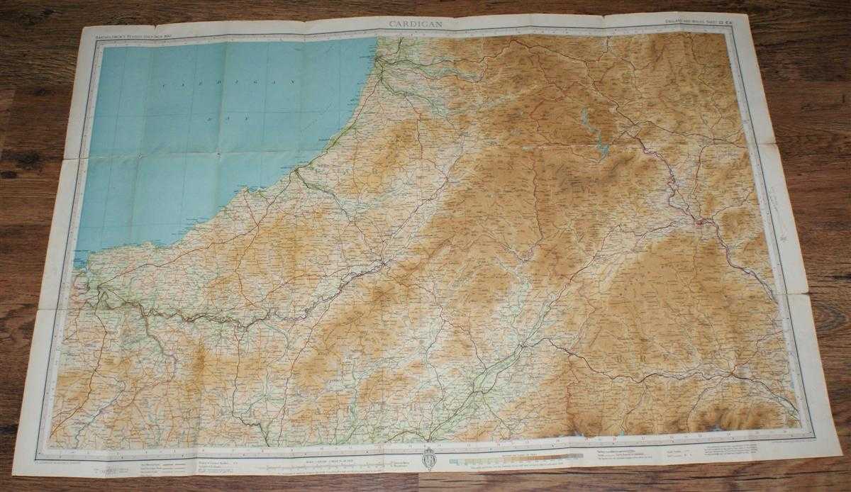
Description: John Bartholomew & Son Ltd. Edinburgh, 1938. Revised Edition, Softcover. Very Good Condition/No Dust Jacket. Single sheet map is cloth backed and has blue card covers. Sheet is folded as for original sale. Scale 1:126,720 or 2 Miles to an Inch. Map is coloured according to contour and main roads are shown in red. Rivers and railways are clearly indicated. A and B road numbers are given. Sheet is worn at some folds, in places the paper has worn through but cloth holds firm. Edges are worn and a little darkened, map remains bright and clear. Covers are a little marked and scuffed. Area covered includes; Aberystwyth, Aberayron, New Quay, Cardigan, Llanddyssul, Llandovery, Brecon, Tregaron, Builth Wells, Rhayader, Llanidloes, Lampetter. Single sheet map/chart which is suitable for framing. Quantity Available: 1. Shipped Weight: under 1 kg. Pictures of this item not already displayed here available upon request. Inventory No: 45119103051. ISBN: 0950919152
Keywords: BZDB4 Maps; Wales and Welsh History, literature & language. John Bartholomew & Son Ltd. Cardigan - Bartholomew's Revised "Half-Inch" Contoured Maps of England and Wales, Sheet 22 (E4) Wales and Welsh History, literature & language
See more books from our catalog: Maps
Title: Cardigan - Bartholomew's Revised "Half-Inch" Contoured Maps of England and Wales, Sheet 22 (E4)
Description: John Bartholomew & Son Ltd. Edinburgh, 1938. Revised Edition, Softcover. Very Good Condition/No Dust Jacket. Single sheet map is cloth backed and has blue card covers. Sheet is folded as for original sale. Scale 1:126,720 or 2 Miles to an Inch. Map is coloured according to contour and main roads are shown in red. Rivers and railways are clearly indicated. A and B road numbers are given. Sheet is worn at some folds, in places the paper has worn through but cloth holds firm. Edges are worn and a little darkened, map remains bright and clear. Covers are a little marked and scuffed. Area covered includes; Aberystwyth, Aberayron, New Quay, Cardigan, Llanddyssul, Llandovery, Brecon, Tregaron, Builth Wells, Rhayader, Llanidloes, Lampetter. Single sheet map/chart which is suitable for framing. Quantity Available: 1. Shipped Weight: under 1 kg. Pictures of this item not already displayed here available upon request. Inventory No: 45119103051. ISBN: 0950919152
Keywords: BZDB4 Maps; Wales and Welsh History, literature & language. John Bartholomew & Son Ltd. Cardigan - Bartholomew's Revised "Half-Inch" Contoured Maps of England and Wales, Sheet 22 (E4) Wales and Welsh History, literature & language
Price: GBP 5.00 = appr. US$ 7.14 Seller: Bailgate Books Ltd
- Book number: 45119103051
- Book number: 45119103051
See more books from our catalog: Maps