Author: Ordnance Survey
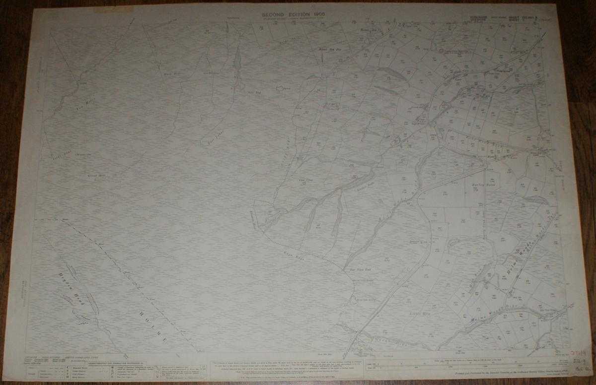
Title: 1:2,500 Ordnance Survey Map, Yorkshire (West Riding) and Cheshire, Sheets CCLXXII.11 and II.11. (part), Second Edition 1905, Surveyed 1887 and 1872, Revised 1904 and 1896, 30/32 50/42, Moor Land Area N/W of Holme
Description: Map Ordnance Survey, 1905. Revised Edition, Softcover. Good Condition/No Dust Jacket. Black and white map. Map area almost clean with only faint smudges. Edges slightly darkened and worn with one tape strip on upper edge. One vertical fold (not central) with other light creasing. Handwritten figures in bottom right margin. Reverse is lightly marked with some slight darkening to edges. 1:2,500 Ordnance Survey Map, Yorkshire (West Riding) and Cheshire, Sheets CCLXXII.11 and II.11. (part), Second Edition 1905, Surveyed 1887 and 1872, Revised 1904 and 1896, 30/32 50/42, Moor Land Area N/W of Holme Includes: Heyden Head, Issue Edge, Kaye Edge, Cliffe Edge, Birchen Bank. Little Hey, Hill Gate Sike, Rake Dyke, Ings Bridge, Peacock Inn, Lane, Gill Hey Bridge Woodhead Road, Holme Woods Lane, Rake Head Road, Information included is buildings, property/field boundaries, acreage, parish and other boundaries, footpaths, tracks, roads, railways, watercourses, orchards and forestation, levels, earthworks, antiquities, etc Size: 73cm by 104cm. Item Type: Map. No dust jacket, as published. Single sheet map/chart which is suitable for framing and will be shipped rolled and in a cardboard tube.. Quantity Available: 1. Shipped Weight: under 1 kg. Pictures of this item not already displayed here available upon request. Inventory No: 45116121347. ISBN: 0750920963
Keywords: BZDB4 map, British history Maps; British History; England; 1900-1920; Yorkshire. Ordnance Survey 1:2,500 Ordnance Survey Map, Yorkshire (West Riding) and Cheshire, Sheets CCLXXII.11 and II.11. (part), Second Edition 1905, Surveyed 1887 and 1872, Revised 1
See more books from our catalog: Maps
Title: 1:2,500 Ordnance Survey Map, Yorkshire (West Riding) and Cheshire, Sheets CCLXXII.11 and II.11. (part), Second Edition 1905, Surveyed 1887 and 1872, Revised 1904 and 1896, 30/32 50/42, Moor Land Area N/W of Holme
Description: Map Ordnance Survey, 1905. Revised Edition, Softcover. Good Condition/No Dust Jacket. Black and white map. Map area almost clean with only faint smudges. Edges slightly darkened and worn with one tape strip on upper edge. One vertical fold (not central) with other light creasing. Handwritten figures in bottom right margin. Reverse is lightly marked with some slight darkening to edges. 1:2,500 Ordnance Survey Map, Yorkshire (West Riding) and Cheshire, Sheets CCLXXII.11 and II.11. (part), Second Edition 1905, Surveyed 1887 and 1872, Revised 1904 and 1896, 30/32 50/42, Moor Land Area N/W of Holme Includes: Heyden Head, Issue Edge, Kaye Edge, Cliffe Edge, Birchen Bank. Little Hey, Hill Gate Sike, Rake Dyke, Ings Bridge, Peacock Inn, Lane, Gill Hey Bridge Woodhead Road, Holme Woods Lane, Rake Head Road, Information included is buildings, property/field boundaries, acreage, parish and other boundaries, footpaths, tracks, roads, railways, watercourses, orchards and forestation, levels, earthworks, antiquities, etc Size: 73cm by 104cm. Item Type: Map. No dust jacket, as published. Single sheet map/chart which is suitable for framing and will be shipped rolled and in a cardboard tube.. Quantity Available: 1. Shipped Weight: under 1 kg. Pictures of this item not already displayed here available upon request. Inventory No: 45116121347. ISBN: 0750920963
Keywords: BZDB4 map, British history Maps; British History; England; 1900-1920; Yorkshire. Ordnance Survey 1:2,500 Ordnance Survey Map, Yorkshire (West Riding) and Cheshire, Sheets CCLXXII.11 and II.11. (part), Second Edition 1905, Surveyed 1887 and 1872, Revised 1
Price: GBP 15.00 = appr. US$ 21.42 Seller: Bailgate Books Ltd
- Book number: 45116121347
- Book number: 45116121347
See more books from our catalog: Maps