Author: Ordnance Survey
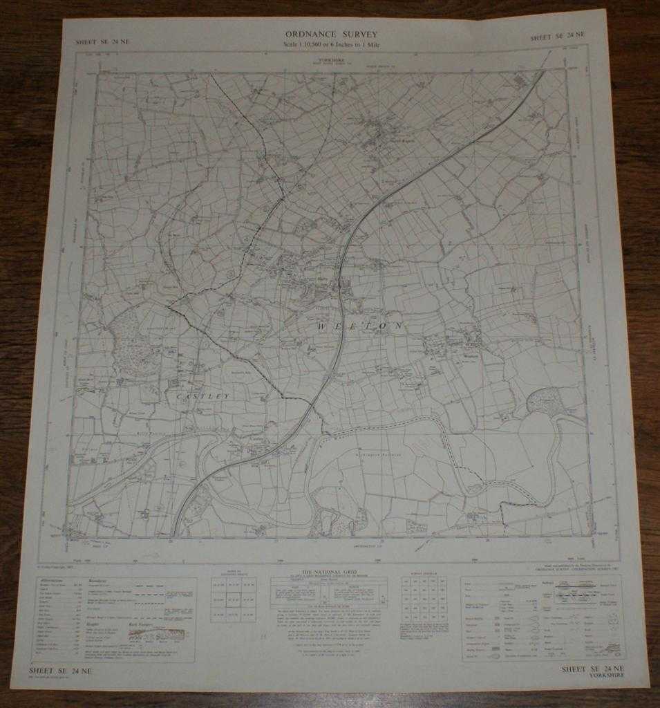
Title: Ordnance Survey (OS) Map 1:10,560 Provisional Edition Sheet SE 24NE. Yorkshire, Weeton, Castley, North Rigton. Major roads revised 1965. Boundaries revised to 1-12-64.
Description: Map Ordnance Survey, Chessington, Surrey, 1967. Provisional Edition, Softcover. Very Good Condition/No Dust Jacket. This map is clean, crisp and unfolded, with a small nick at the right-hand edge. Pencilled projections of (probably) a new road. It has been stored flat, will be supplied in a cardboard tube and is ideal for mounting/ framing. The area covered is in Yorkshire and includes Pool, Castley, Celler Hill, Staniston Hill, North Rigton, Mawking Hill, Huby, Weeton, Arthington Pastures, Rougemont Carr, Healthwaite Hill, Dunkeswick Lodge, etc. etc. General information shown includes towns, villages, hamlets, footpaths, tracks, roads, railways, watercourses, orchards and forestation, levels, earthworks, antiquities etc. and contour lines in brown. Size: Approx 560mm wide by 675mm. 1 pages. Item Type: Map. Single sheet map/chart. Quantity Available: 1. Shipped Weight: under 1 kg. Pictures of this item not already displayed here available upon request. Inventory No: 45115090168. ISBN: 0715392522
Keywords: BZDB4 , OS map, flat map, Yorkshire Maps; England; Yorkshire. Ordnance Survey Ordnance Survey (OS) Map 1:10,560 Provisional Edition Sheet SE 24NE. Yorkshire, Weeton, Castley, North Rigton. Major roads revised 1965. Boundaries revised to 1-12-64. Yorksh
See more books from our catalog: Maps
Title: Ordnance Survey (OS) Map 1:10,560 Provisional Edition Sheet SE 24NE. Yorkshire, Weeton, Castley, North Rigton. Major roads revised 1965. Boundaries revised to 1-12-64.
Description: Map Ordnance Survey, Chessington, Surrey, 1967. Provisional Edition, Softcover. Very Good Condition/No Dust Jacket. This map is clean, crisp and unfolded, with a small nick at the right-hand edge. Pencilled projections of (probably) a new road. It has been stored flat, will be supplied in a cardboard tube and is ideal for mounting/ framing. The area covered is in Yorkshire and includes Pool, Castley, Celler Hill, Staniston Hill, North Rigton, Mawking Hill, Huby, Weeton, Arthington Pastures, Rougemont Carr, Healthwaite Hill, Dunkeswick Lodge, etc. etc. General information shown includes towns, villages, hamlets, footpaths, tracks, roads, railways, watercourses, orchards and forestation, levels, earthworks, antiquities etc. and contour lines in brown. Size: Approx 560mm wide by 675mm. 1 pages. Item Type: Map. Single sheet map/chart. Quantity Available: 1. Shipped Weight: under 1 kg. Pictures of this item not already displayed here available upon request. Inventory No: 45115090168. ISBN: 0715392522
Keywords: BZDB4 , OS map, flat map, Yorkshire Maps; England; Yorkshire. Ordnance Survey Ordnance Survey (OS) Map 1:10,560 Provisional Edition Sheet SE 24NE. Yorkshire, Weeton, Castley, North Rigton. Major roads revised 1965. Boundaries revised to 1-12-64. Yorksh
Price: GBP 9.50 = appr. US$ 13.57 Seller: Bailgate Books Ltd
- Book number: 45115090168
- Book number: 45115090168
See more books from our catalog: Maps