Author: John Bartholomew
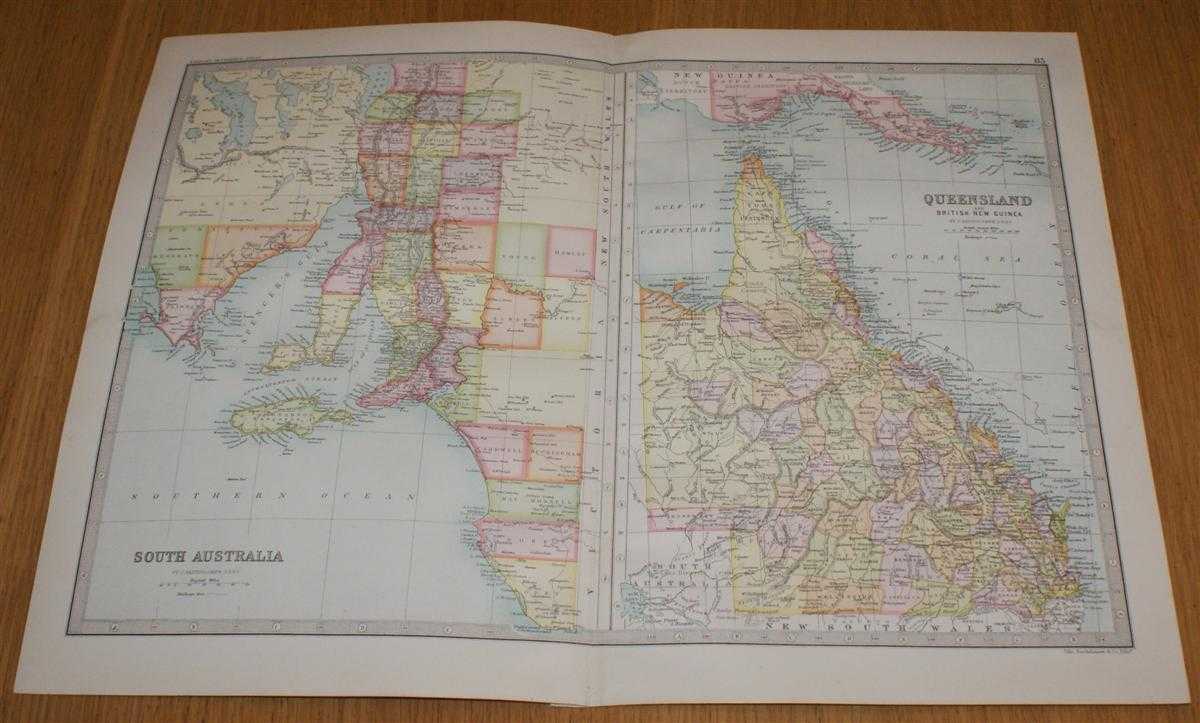
Title: Map of Queensland and British New Guinea, and South Australia (eastern half only) - Sheet 83 Disbound from the 1890 'The Library Reference Atlas of the World'
Description: Macmillan and Co. London, 1890. First Edition, Softcover. Very Good Condition/No Dust Jacket. Single disbound coloured map sheet from John Bartholomew's Library Reference Atlas. Suitable for framing. Approx size 35 x 46 cm, vertical centre fold. Map is clean, crisp, clear and bright. Sheet is split into two panels with South Australia on the left and Queensland and British New Guinea on the right. The two parts are at different scales. The South Australia section covers the eastern half of this region only and includes Port Lincoln, Lake Gairdner, Spencer's Gulf, Gulf of St Vincent, Adelaide, Kangaroo Island and Mount Gambier. The Queensland section covers the whole state, as well as Torres Strait, British New Guinea (parts of modern day Papau New Guinea), D'Entrecasteaux and Louisiade Archipelagos, Cape York Peninsula and part of the Great Barrier Reefs. No dust jacket, as published. Quantity Available: 1. Shipped Weight: under 1 kg. Pictures of this item not already displayed here available upon request. Inventory No: 45020124025. ISBN: 0297831518
Keywords: BZDB4 Maps; Geology, geography, mineralogy, environment; World History; Australasia and the Pacific. John Bartholomew Map of Queensland and British New Guinea, and South Australia (eastern half only) - Sheet 83 Disbound from the 1890 'The Library Referenc
See more books from our catalog: Maps
Title: Map of Queensland and British New Guinea, and South Australia (eastern half only) - Sheet 83 Disbound from the 1890 'The Library Reference Atlas of the World'
Description: Macmillan and Co. London, 1890. First Edition, Softcover. Very Good Condition/No Dust Jacket. Single disbound coloured map sheet from John Bartholomew's Library Reference Atlas. Suitable for framing. Approx size 35 x 46 cm, vertical centre fold. Map is clean, crisp, clear and bright. Sheet is split into two panels with South Australia on the left and Queensland and British New Guinea on the right. The two parts are at different scales. The South Australia section covers the eastern half of this region only and includes Port Lincoln, Lake Gairdner, Spencer's Gulf, Gulf of St Vincent, Adelaide, Kangaroo Island and Mount Gambier. The Queensland section covers the whole state, as well as Torres Strait, British New Guinea (parts of modern day Papau New Guinea), D'Entrecasteaux and Louisiade Archipelagos, Cape York Peninsula and part of the Great Barrier Reefs. No dust jacket, as published. Quantity Available: 1. Shipped Weight: under 1 kg. Pictures of this item not already displayed here available upon request. Inventory No: 45020124025. ISBN: 0297831518
Keywords: BZDB4 Maps; Geology, geography, mineralogy, environment; World History; Australasia and the Pacific. John Bartholomew Map of Queensland and British New Guinea, and South Australia (eastern half only) - Sheet 83 Disbound from the 1890 'The Library Referenc
Price: GBP 33.00 = appr. US$ 47.12 Seller: Bailgate Books Ltd
- Book number: 45020124025
- Book number: 45020124025
See more books from our catalog: Maps