Author: The Times and J. G. Bartholomew
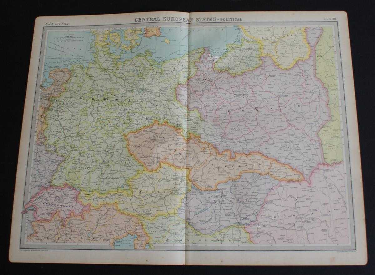
Title: Map of "Central European States" from 1920 Times Atlas (Plate 38) including Germany, Switzerland, Austria, Czheco-Slovakia, Hungary and Poland with parts of Lithuania, Yugo-Slavia, Italy, Denmark and Rumania
Description: The Times, London, 1920. First Edition, Softcover. Very Good Condition/No Dust Jacket. Disbound single sheet with vertical centre fold from the 1920 "The Times Survey Atlas of the World". Map is in colour and suitable for framing. Colour is according to country with slightly darker shades marking the borders and matching pastel shade infills. Map at scale 1:3,000,000. Map covers Germany, Switzerland, Austria, Czheco-Slovakia, Hungary and Poland with parts of Lithuania, Yugo-Slavia, Italy, Denmark and Rumania and covers modern day Liechtenstein, Slovenia, Czech Republic and Slovakia Slightly darkened edges with some occasional light foxing in the margins and at the centre fold. Sheet is otherwise crisp, clean and bright. Size: 46 x 58cm approx. Quantity Available: 1. Shipped Weight: under 1 kg. Pictures of this item not already displayed here available upon request. Inventory No: 45020044015. ISBN: 0586044434
Keywords: BZDB4 Maps; Germany, Austria, Switzerland and German Language; Russia & Eastern Europe; European History. The Times and J. G. Bartholomew Map of "Central European States" from 1920 Times Atlas (Plate 38) including Germany, Switzerland, Austria, Czheco-Slo
See more books from our catalog: Maps
Title: Map of "Central European States" from 1920 Times Atlas (Plate 38) including Germany, Switzerland, Austria, Czheco-Slovakia, Hungary and Poland with parts of Lithuania, Yugo-Slavia, Italy, Denmark and Rumania
Description: The Times, London, 1920. First Edition, Softcover. Very Good Condition/No Dust Jacket. Disbound single sheet with vertical centre fold from the 1920 "The Times Survey Atlas of the World". Map is in colour and suitable for framing. Colour is according to country with slightly darker shades marking the borders and matching pastel shade infills. Map at scale 1:3,000,000. Map covers Germany, Switzerland, Austria, Czheco-Slovakia, Hungary and Poland with parts of Lithuania, Yugo-Slavia, Italy, Denmark and Rumania and covers modern day Liechtenstein, Slovenia, Czech Republic and Slovakia Slightly darkened edges with some occasional light foxing in the margins and at the centre fold. Sheet is otherwise crisp, clean and bright. Size: 46 x 58cm approx. Quantity Available: 1. Shipped Weight: under 1 kg. Pictures of this item not already displayed here available upon request. Inventory No: 45020044015. ISBN: 0586044434
Keywords: BZDB4 Maps; Germany, Austria, Switzerland and German Language; Russia & Eastern Europe; European History. The Times and J. G. Bartholomew Map of "Central European States" from 1920 Times Atlas (Plate 38) including Germany, Switzerland, Austria, Czheco-Slo
Price: GBP 24.00 = appr. US$ 34.27 Seller: Bailgate Books Ltd
- Book number: 45020044015
- Book number: 45020044015
See more books from our catalog: Maps