Author: The Times and J. G. Bartholomew
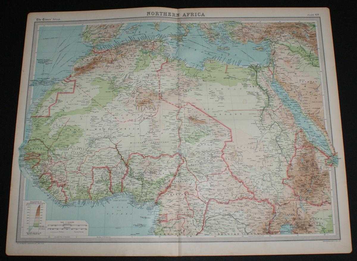
Title: Map of Northern Africa from the 1920 Times Survey Atlas (Plate 69) including Morocco, Algeria, Libya, Egypt, Senegal, French West Africa, Nigeria, Cameroon, Uganda, Red Sea, etc.
Description: Map The Times, London, 1920. First Edition, Softcover. Very Good Condition/No Dust Jacket. Disbound single sheet with vertical centre fold from the 1920 "The Times Survey Atlas of the World". Map is in colour and suitable for framing. Colour on both land and sea according to contour with borders marked in red. Map at scale 1:12,000,000. Map covers; Morocco, Algeria, Libya, Egypt, Senegal, French West Africa, Nigeria, Cameroon, Uganda, Ivory Coast, Gold Coast, French Guinea, Borku, Chad, Abyssinia (part), Belgian Congo (part), Madeira Islands, Canary Islands, Spain (part), Red Sea, Gulf of Guinea, Mediterranean Sea (part), Arabia (part), etc. Slightly darkened edges with occasional light foxing in margins but sheet is otherwise clean and crisp. Item Type: Map. Single sheet map/chart which is suitable for framing and will be shipped rolled and in a cardboard tube. Quantity Available: 1. Shipped Weight: under 1 kg. Pictures of this item not already displayed here available upon request. Inventory No: 45020034028. ISBN: 0850335086
Keywords: BZDB4 Maps; World History; naval, naval history, maritime, ships, boats; Africa. The Times and J. G. Bartholomew Map of Northern Africa from the 1920 Times Survey Atlas (Plate 69) including Morocco, Algeria, Libya, Egypt, Senegal, French West Africa, Nige
See more books from our catalog: Maps
Title: Map of Northern Africa from the 1920 Times Survey Atlas (Plate 69) including Morocco, Algeria, Libya, Egypt, Senegal, French West Africa, Nigeria, Cameroon, Uganda, Red Sea, etc.
Description: Map The Times, London, 1920. First Edition, Softcover. Very Good Condition/No Dust Jacket. Disbound single sheet with vertical centre fold from the 1920 "The Times Survey Atlas of the World". Map is in colour and suitable for framing. Colour on both land and sea according to contour with borders marked in red. Map at scale 1:12,000,000. Map covers; Morocco, Algeria, Libya, Egypt, Senegal, French West Africa, Nigeria, Cameroon, Uganda, Ivory Coast, Gold Coast, French Guinea, Borku, Chad, Abyssinia (part), Belgian Congo (part), Madeira Islands, Canary Islands, Spain (part), Red Sea, Gulf of Guinea, Mediterranean Sea (part), Arabia (part), etc. Slightly darkened edges with occasional light foxing in margins but sheet is otherwise clean and crisp. Item Type: Map. Single sheet map/chart which is suitable for framing and will be shipped rolled and in a cardboard tube. Quantity Available: 1. Shipped Weight: under 1 kg. Pictures of this item not already displayed here available upon request. Inventory No: 45020034028. ISBN: 0850335086
Keywords: BZDB4 Maps; World History; naval, naval history, maritime, ships, boats; Africa. The Times and J. G. Bartholomew Map of Northern Africa from the 1920 Times Survey Atlas (Plate 69) including Morocco, Algeria, Libya, Egypt, Senegal, French West Africa, Nige
Price: GBP 24.00 = appr. US$ 34.27 Seller: Bailgate Books Ltd
- Book number: 45020034028
- Book number: 45020034028
See more books from our catalog: Maps