Author: The Times and J. G. Bartholomew
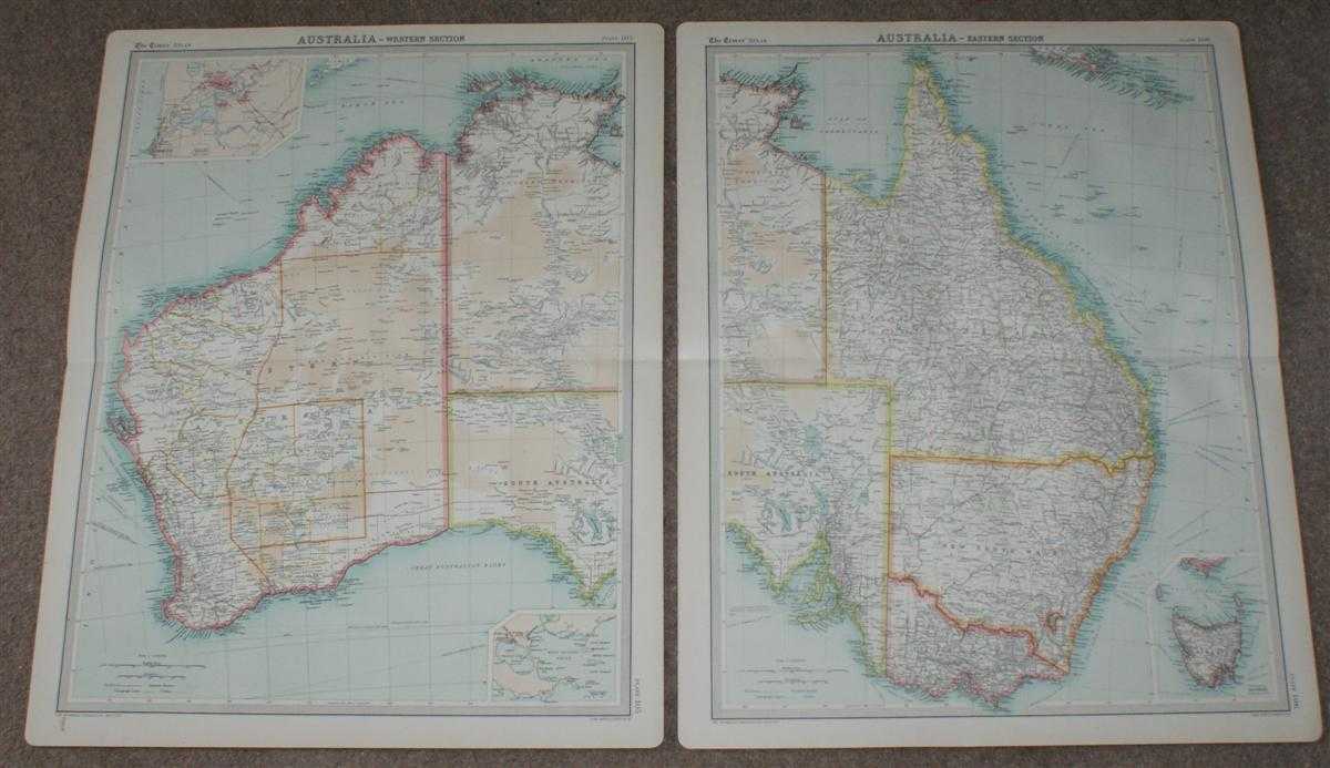
Title: Map of Australia in 2 sheets from the 1920 Times Survey Atlas (Plates 105 and 106)
Description: Map The Times, London, 1920. First Edition, Softcover. Very Good Condition/No Dust Jacket. Two disbound sheets with horizontal centre folds from the 1920 "The Times Survey Atlas of the World". Map of Australia is spread across two sheets - Plate 105 Western Section and Plate 106 Eastern Section. Map is in colour and suitable for framing. Map scale 1:6,000,000 with inset of Perth and Freemantle at 1:200,000 and Albany at 1:250,000. Area covered includes the whole of Australia with Tasmania included as an inset, also covered: Gulf of Carpentaria, Great Barrier Reef, Coral Sea, Louisiade Archipelago, Great Australian Bight, Timor Sea, Arafura Sea, Sydney, Canberra, Macdonnell Range, Great Sandy Desert, Gibson's Desert, Sharks Bay, Perth, Melville Island, Bass Strait, etc. etc. State boundaries are clearly marked in colour, detailed hatching indicates mountain ranges, deserts and water bodies are coloured. Slightly darkened edges and very occasional light foxing but sheets are otherwise clean and crisp. Item Type: Map. Single sheet map/chart which is suitable for framing and will be shipped rolled and in a cardboard tube. Quantity Available: 1. Shipped Weight: under 1 kg. Pictures of this item not already displayed here available upon request. Inventory No: 45020034007. ISBN: 0850335086
Keywords: BZDB4 Maps; naval, naval history, maritime, ships, boats; World History; Australasia and the Pacific. The Times and J. G. Bartholomew Map of Australia in 2 sheets from the 1920 Times Survey Atlas (Plates 105 and 106) naval, naval history, maritime, ships,
See more books from our catalog: Maps
Title: Map of Australia in 2 sheets from the 1920 Times Survey Atlas (Plates 105 and 106)
Description: Map The Times, London, 1920. First Edition, Softcover. Very Good Condition/No Dust Jacket. Two disbound sheets with horizontal centre folds from the 1920 "The Times Survey Atlas of the World". Map of Australia is spread across two sheets - Plate 105 Western Section and Plate 106 Eastern Section. Map is in colour and suitable for framing. Map scale 1:6,000,000 with inset of Perth and Freemantle at 1:200,000 and Albany at 1:250,000. Area covered includes the whole of Australia with Tasmania included as an inset, also covered: Gulf of Carpentaria, Great Barrier Reef, Coral Sea, Louisiade Archipelago, Great Australian Bight, Timor Sea, Arafura Sea, Sydney, Canberra, Macdonnell Range, Great Sandy Desert, Gibson's Desert, Sharks Bay, Perth, Melville Island, Bass Strait, etc. etc. State boundaries are clearly marked in colour, detailed hatching indicates mountain ranges, deserts and water bodies are coloured. Slightly darkened edges and very occasional light foxing but sheets are otherwise clean and crisp. Item Type: Map. Single sheet map/chart which is suitable for framing and will be shipped rolled and in a cardboard tube. Quantity Available: 1. Shipped Weight: under 1 kg. Pictures of this item not already displayed here available upon request. Inventory No: 45020034007. ISBN: 0850335086
Keywords: BZDB4 Maps; naval, naval history, maritime, ships, boats; World History; Australasia and the Pacific. The Times and J. G. Bartholomew Map of Australia in 2 sheets from the 1920 Times Survey Atlas (Plates 105 and 106) naval, naval history, maritime, ships,
Price: GBP 38.00 = appr. US$ 54.26 Seller: Bailgate Books Ltd
- Book number: 45020034007
- Book number: 45020034007
See more books from our catalog: Maps