Author:
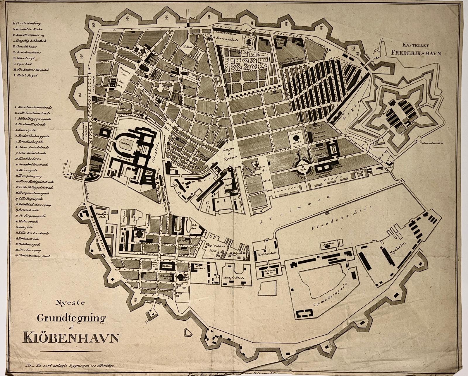
Title: Antique print, cartography | Map of Copenhagen (Kopenhagen plattegrond), published 1826, 1 p.
Description: Map of the city of Copenhagen. Public buildings marked in black. With numbered place register on the left.Titled below: Nyeste Grundtegning af Kiöbehavn.With the address of the publisher below.According to the Royal library of Denmark, to be found in Christensen: Description of Copenhagen [Beskrivelseover Kjøbenhavn] from 1821.[NL] Kaart van de stad Kopenhagen. Openbare gebouwen zijn zwart gemarkeerd. Met genummerde plaatsregistratie aan de linkerkant.Hieronder getiteld: Nyeste Grundtegning af Kiöbehavn. Met hieronder het adres van de uitgever.Volgens de Koninklijke Bibliotheek van Denemarken, te vinden in Christensen: Beschrijving van Kopenhagen [Bescrivelseover Kjøbenhavn] uit 1821. Etching and engraving on paper, trimmed within plate mark; total: 355 x 425 mm; folding crease at center, frayed margins, especially at bottom.
Keywords: Cartography|Scandinavia
Price: EUR 181.50 = appr. US$ 197.26 Seller: Antiquariaat Arine van der Steur
- Book number: PR121481
- Book number: PR121481