Author: Marie Joseph François Garnier (1839-1873)
Title: Cartography, colored lithography | Oceanie in 1860, published 1862, 1 p.
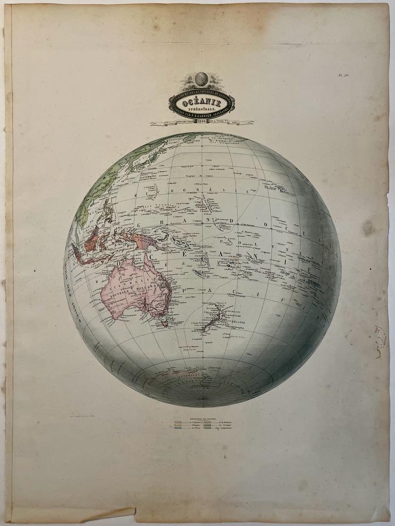
Description: Map of Oceanie, including the South Pole, a view of Australia, New Zealand and the Pacific islands. On the bottom a legend indicating in different colours the areas of colonial relevance, and the independent countries.Titled in vignette: Oceanie.Indications of mountains and rivers. Map included in Atlas Spheroidal et Universel de Geographie by M.F.A. Garnier published in Paris at Veuve Jules Renouard in 1862 [pl. 20].As this plate shows, this atlas is exceptional for its spheroidal maps of the globe, showing the various continents and poles, shaded to give the effect of a sphere floating in space. The remaining maps are also very well executed and colored, mostly by hand, a few in colored litho.[NL] Kaart van Oceanie. Antieke kaart van wereldbol met daarop Oceanië in 1860. Colored lithography, total: 584 x 436 mm, some foxing, tears and damages on the margins, overall in good condition.
Keywords: America|Cartography
Title: Cartography, colored lithography | Oceanie in 1860, published 1862, 1 p.
Description: Map of Oceanie, including the South Pole, a view of Australia, New Zealand and the Pacific islands. On the bottom a legend indicating in different colours the areas of colonial relevance, and the independent countries.Titled in vignette: Oceanie.Indications of mountains and rivers. Map included in Atlas Spheroidal et Universel de Geographie by M.F.A. Garnier published in Paris at Veuve Jules Renouard in 1862 [pl. 20].As this plate shows, this atlas is exceptional for its spheroidal maps of the globe, showing the various continents and poles, shaded to give the effect of a sphere floating in space. The remaining maps are also very well executed and colored, mostly by hand, a few in colored litho.[NL] Kaart van Oceanie. Antieke kaart van wereldbol met daarop Oceanië in 1860. Colored lithography, total: 584 x 436 mm, some foxing, tears and damages on the margins, overall in good condition.
Keywords: America|Cartography
Price: EUR 90.75 = appr. US$ 98.63 Seller: Antiquariaat Arine van der Steur
- Book number: PR121453
- Book number: PR121453