Author: Marie Joseph François Garnier (1839-1873)
Title: Cartography, colored lithography | Italy in 1861 (gekleurde kaart van Italie), published 1862, 1 p.
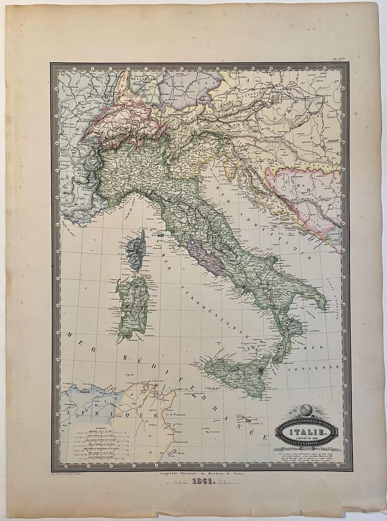
Description: Map of the Reign of Italy after the unification in 1861. Notably, the Lombardo-Veneto is still not included as well as the Lazio region, then the Pontifical State.Indications of mountains and rivers. Map included in Atlas Spheroidal et Universel de Geographie by M.F.A. Garnier published in Paris at Veuve Jules Renouard in 1862. As mentioned on the bottom right corner, this map was shown with another depicting the political situation in 1859.With scales and measurements at bottom left.This atlas is exceptional for its spheroidal maps of the globe, showing the various continents and poles, shaded to give the effect of a sphere floating in space. The remaining maps are also very well executed and colored, mostly by hand, a few in colored litho.[NL] Kaart van de regering van Italië na de eenwording in 1861. Colored lithography, total: 583 x 430 mm, some foxing on the margins, some tears at bottom, overall in good condition.
Keywords: Cartography|Italy
Title: Cartography, colored lithography | Italy in 1861 (gekleurde kaart van Italie), published 1862, 1 p.
Description: Map of the Reign of Italy after the unification in 1861. Notably, the Lombardo-Veneto is still not included as well as the Lazio region, then the Pontifical State.Indications of mountains and rivers. Map included in Atlas Spheroidal et Universel de Geographie by M.F.A. Garnier published in Paris at Veuve Jules Renouard in 1862. As mentioned on the bottom right corner, this map was shown with another depicting the political situation in 1859.With scales and measurements at bottom left.This atlas is exceptional for its spheroidal maps of the globe, showing the various continents and poles, shaded to give the effect of a sphere floating in space. The remaining maps are also very well executed and colored, mostly by hand, a few in colored litho.[NL] Kaart van de regering van Italië na de eenwording in 1861. Colored lithography, total: 583 x 430 mm, some foxing on the margins, some tears at bottom, overall in good condition.
Keywords: Cartography|Italy
Price: EUR 90.75 = appr. US$ 98.63 Seller: Antiquariaat Arine van der Steur
- Book number: PR121448
- Book number: PR121448