Author: Leth, De A. en H.
Title: Original map/Originele kaart/Antique print/prent: Het Watergraafs of Diemer-Meer, ca 1725.
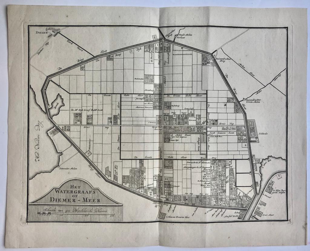
Description: Hollands Watergraafsmeer. Copperengraving published by Andries and Hendrik de Leth, ca 1725. 355 x 440 mm. Two vertical folds in the two page size map. In very good condition. The map shows Diemen, Het nieuwe Diep, Harvelder Brug, Solitudo, Somer lust, De Ring sloot, etc.
Keywords: Amsterdam|Cartography|Topography & Travel
Title: Original map/Originele kaart/Antique print/prent: Het Watergraafs of Diemer-Meer, ca 1725.
Description: Hollands Watergraafsmeer. Copperengraving published by Andries and Hendrik de Leth, ca 1725. 355 x 440 mm. Two vertical folds in the two page size map. In very good condition. The map shows Diemen, Het nieuwe Diep, Harvelder Brug, Solitudo, Somer lust, De Ring sloot, etc.
Keywords: Amsterdam|Cartography|Topography & Travel
Price: EUR 151.25 = appr. US$ 164.39 Seller: Antiquariaat Arine van der Steur
- Book number: 67354
- Book number: 67354