Author: Robijn, Jacobus (ca. 1647-ca. 1707) after a drawing possibly of Luyken, Jan (1649-1712)
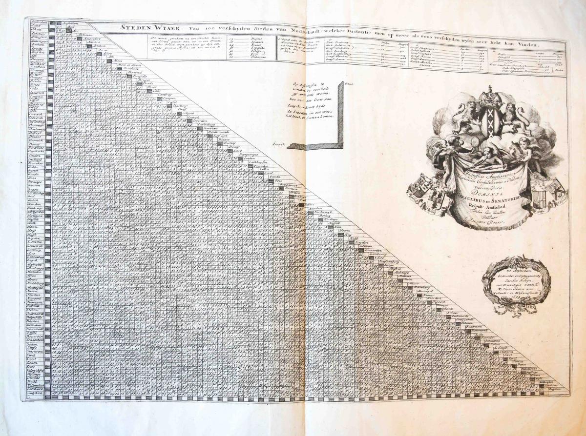
Title: Steden wyser van 100 verschyden steden van Nederlandt, welcker distantie men op meer als 6000 verschyden wysen seer licht kan vinden.
Description: Large page with a chart presenting the distances between different cites in Holland. On the top further indications on the scale used for measuring the distances and the correspondences with the measuring system of other countries in Europe. Further indications on the amount of cities and villages of Holland, divided among regions are given in a chart under the title. Quite an impressive work! On the right the crest of Amsterdam and some putti holding a curtain with an inscription: 'Magnificis Amplissimis / Clarissimis Consultissimis et Pruden-/tissimis Viris. / DOMINIS / CONSULIBUS ET SENATORIBUS / Reipub: Amstelod: / Tabulam hanc humillime / Dedicat / JACOBUS ROBYN'; on the sides four coats of arms of members of the city council of Amsterdam: J. Huydekoper, J. Hudde, N. Witsen en J. Boreel. in a garland just below the privilege and the address of the publisher. Etching and engraving on laid paper with broad margins: plate mark: 390 x 581 mm, total: 526 x 633 mm; some light damages along the margins; signs of foldings especially in the middle, reinforced on the verso; fold on the bottom right corner; on the verso top left corner pen scribbelings in brown ink. Very bright impression.
Keywords: Topography & Travel
Price: EUR 332.75 = appr. US$ 361.65 Seller: Antiquariaat Arine van der Steur
- Book number: 61575
- Book number: 61575