Author: World map.
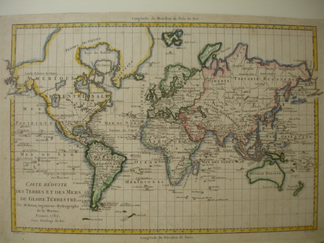
Title: Carte Réduite des Terres et des Mers du Globe Terrestre.
Description: Copper engraved handcoloured world map on Mercator's projection by M. Bonne; 32,5 x 21,5 cm. From Atlas Portatif. Greenland and the Arctic are attached to North America. Alaska is shown with a rudimentary shape. The most interesting features are the large inland sea in the Pacific Northwest with its outlet named "Canal du Roi George" and a river connecting it to Hudson Bay. Above this is another large lake with a huge river flowing to the Pacific at "Is. San Carlos". Australia is named "Nouvelle Holland" and includes "Terre de Diemen". Numerous small islands are shown throughout the world. Map mounted on cardboard.
Keywords: copper engravings/kopergravures foreign maps and prints world maps
Price: EUR 250.00 = appr. US$ 271.71 Seller: Antiquariaat De Boekenbeurs
- Book number: 27434
- Book number: 27434