Author:
Title: General Map of Iran with Complete Details.
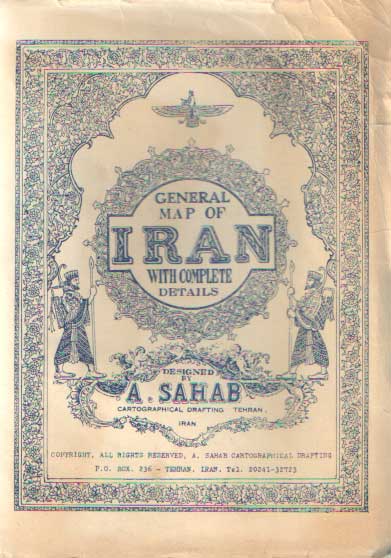
Description: Tehran, A. Sahab Geographic & Draftig Institute, 1955. 99,5 x 70 cm. A 1950s map of Iran with 11 thematic in-set maps and original hand colour, was based on the free-hand drawing by Abbas Sahab - Father of Iran's Cartography. This magnificent map of Iran with eleven in-set thematic maps and one chart was printed in Tehran in 1955. The in-set maps show:- Iranian Industries, Factories, Handicrafts,- Historical Monuments,- Tribal Costumes,- Mountain Chains,- Fauna and Flora,- Principal Air Routes,- Highways, Railways, Waterways and Distances,- Location of Iran in the World,- Forest Regions,- Mineral Mines,- Basic information. Cover with some flaws, the map itself in very good condition. Scale 1:3,500,000. Cond.: goed / good.
Keywords:
See more books from our catalog: Landen - Countries
Title: General Map of Iran with Complete Details.
Description: Tehran, A. Sahab Geographic & Draftig Institute, 1955. 99,5 x 70 cm. A 1950s map of Iran with 11 thematic in-set maps and original hand colour, was based on the free-hand drawing by Abbas Sahab - Father of Iran's Cartography. This magnificent map of Iran with eleven in-set thematic maps and one chart was printed in Tehran in 1955. The in-set maps show:- Iranian Industries, Factories, Handicrafts,- Historical Monuments,- Tribal Costumes,- Mountain Chains,- Fauna and Flora,- Principal Air Routes,- Highways, Railways, Waterways and Distances,- Location of Iran in the World,- Forest Regions,- Mineral Mines,- Basic information. Cover with some flaws, the map itself in very good condition. Scale 1:3,500,000. Cond.: goed / good.
Keywords:
Price: EUR 600.00 = appr. US$ 652.11 Seller: Bij tij en ontij . . . .
- Book number: 76578
- Book number: 76578
See more books from our catalog: Landen - Countries