Author: KRAIJENHOFF, Cornelis
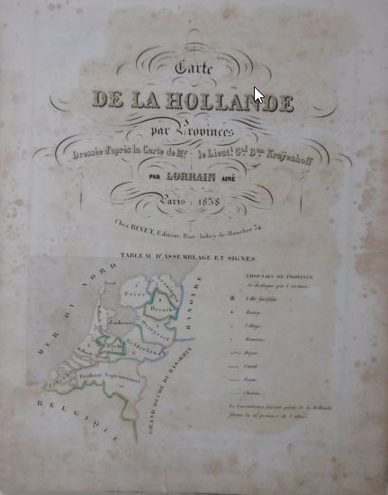
Title: Carte de la Hollande par provinces. Dressée d'après la carte de Mr. le Lieut. Gal. Bon. Kraijenhoff par Lorrain Ainé.
Description: Paris, Binet, 1838. Oblong 8vo. Contemporary half calf (verso front board strengthend), spine richly gilt (top of spine sl. dam.). With steelengraved title-page and 11 steelengraved maps (1 folding), +1 extra map depicting Java, all handcoloured in outline. Bound with: C.V. MONIN & A.R. FRÉMIN. Atlas universel de géographie ancienne et moderne. Paris, Binet, (1835). Steelengraved title-page, folding plate tableau cosmographique, 12 maps of the ancient world and 37 maps of the modern world (including worldmap), all steelengraved and handcoloured in outline by Bénard. - (Some foxing and age-browning).
Keywords: America Asia Dutch topography Europe Holland prints travel
Price: EUR 412.50 = appr. US$ 448.32 Seller: Gert Jan Bestebreurtje Rare Books (NVvA/ILAB)
- Book number: 37084
- Book number: 37084