Author: Admiralty
Title: Nautical Chart No. 3019 Norway - West Coast, Approaches to Haugesund
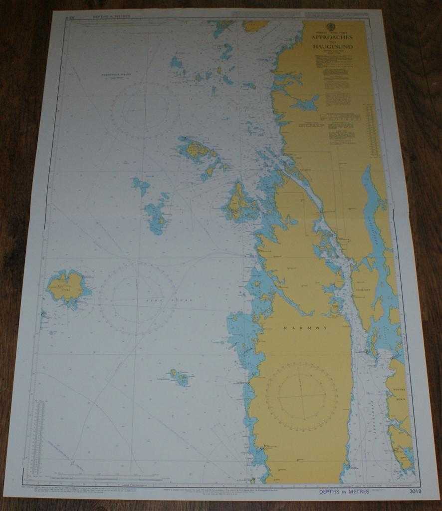
Description: Admiralty, 2005. Revised Edition, Softcover. Very Good Condition/No Dust Jacket. Crisp and clean colour chart with single horizontal fold. Nautical Chart No. 3019 Norway - West Coast, Approaches to Haugesund. Copyright 1984 with small corrections to 2005. Scale 1:50,000. Area Covered: Norway (part), Karmoy, Fosenoy, Vestre Bokn, Hsugesund, Feoy, Rovaer, Utsira, Bomlo (part). Sira Fjord, Karmsudnet, Fordesfjord, Bomlafjorden, Sletta. Size: 104x72cm. Single sheet map/chart which is suitable for framing and will be shipped rolled and in a cardboard tube. Quantity Available: 1. Shipped Weight: under 1 kg. Pictures of this item not already displayed here available upon request. Inventory No: 45517074026. ISBN: 0718118413
Keywords: BZDB4 naval, naval history, maritime, ships, boats; Maps; Scandinavia. Admiralty Nautical Chart No. 3019 Norway - West Coast, Approaches to Haugesund Maps Scandinavia
See more books from our catalog: naval, naval history, maritime, ships, boats
Title: Nautical Chart No. 3019 Norway - West Coast, Approaches to Haugesund
Description: Admiralty, 2005. Revised Edition, Softcover. Very Good Condition/No Dust Jacket. Crisp and clean colour chart with single horizontal fold. Nautical Chart No. 3019 Norway - West Coast, Approaches to Haugesund. Copyright 1984 with small corrections to 2005. Scale 1:50,000. Area Covered: Norway (part), Karmoy, Fosenoy, Vestre Bokn, Hsugesund, Feoy, Rovaer, Utsira, Bomlo (part). Sira Fjord, Karmsudnet, Fordesfjord, Bomlafjorden, Sletta. Size: 104x72cm. Single sheet map/chart which is suitable for framing and will be shipped rolled and in a cardboard tube. Quantity Available: 1. Shipped Weight: under 1 kg. Pictures of this item not already displayed here available upon request. Inventory No: 45517074026. ISBN: 0718118413
Keywords: BZDB4 naval, naval history, maritime, ships, boats; Maps; Scandinavia. Admiralty Nautical Chart No. 3019 Norway - West Coast, Approaches to Haugesund Maps Scandinavia
Price: GBP 26.00 = appr. US$ 37.13 Seller: Bailgate Books Ltd
- Book number: 45517074026
- Book number: 45517074026
See more books from our catalog: naval, naval history, maritime, ships, boats