Author: Edited by J. A. Hammerton; Miss H. B. Leach, H. W. Cribb and J. T. Rankin
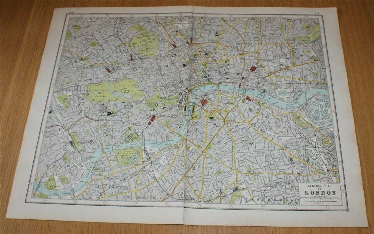
Title: Street Plan of London from Harmsworth's 1922 Atlas of the World
Description: The Educational Book Co. Ltd. London, 1922. Early Edition, Softcover. Very Good Condition/No Dust Jacket. Disbound street plan of Paris from Harmsworth's Atlas of the World and Pictorial Gazetteer. Sheet is in colour and has vertical centre join. Sheet size is approximately 37 x 48cm. Occasional light foxing in margins, sheet is otherwise clean and bright. Sheet covers London form Pentonville Prison in the north, Ruskin Park in the South, Station Olympia to the east and Surrey Commercial Dock s to West. This includes Central London, Southwark, Bermondsey, Chelsea, Holborn, Bewthnal Green, Marylebone, Hyde Park, Kensington Gardens, Battersea Park, Regent's Park, Mile End Workhouse, Brompton Cemetery, etc. Railway, tram and underground railway routes are indicated. No dust jacket, as published. Undated by publisher. Single sheet map/chart which is suitable for framing . Dated by reference to COPAC/Library Hub Discover. Quantity Available: 1. Shipped Weight: under 1 kg. Pictures of this item not already displayed here available upon request. Inventory No: 45321024024. ISBN: 3572074428
Keywords: BZDB4 Maps; British History; Architecture; London & the South East. Edited by J. A. Hammerton; Miss H. B. Leach, H. W. Cribb and J. T. Rankin Street Plan of London from Harmsworth's 1922 Atlas of the World British History Architecture London & the South
See more books from our catalog: Maps
Title: Street Plan of London from Harmsworth's 1922 Atlas of the World
Description: The Educational Book Co. Ltd. London, 1922. Early Edition, Softcover. Very Good Condition/No Dust Jacket. Disbound street plan of Paris from Harmsworth's Atlas of the World and Pictorial Gazetteer. Sheet is in colour and has vertical centre join. Sheet size is approximately 37 x 48cm. Occasional light foxing in margins, sheet is otherwise clean and bright. Sheet covers London form Pentonville Prison in the north, Ruskin Park in the South, Station Olympia to the east and Surrey Commercial Dock s to West. This includes Central London, Southwark, Bermondsey, Chelsea, Holborn, Bewthnal Green, Marylebone, Hyde Park, Kensington Gardens, Battersea Park, Regent's Park, Mile End Workhouse, Brompton Cemetery, etc. Railway, tram and underground railway routes are indicated. No dust jacket, as published. Undated by publisher. Single sheet map/chart which is suitable for framing . Dated by reference to COPAC/Library Hub Discover. Quantity Available: 1. Shipped Weight: under 1 kg. Pictures of this item not already displayed here available upon request. Inventory No: 45321024024. ISBN: 3572074428
Keywords: BZDB4 Maps; British History; Architecture; London & the South East. Edited by J. A. Hammerton; Miss H. B. Leach, H. W. Cribb and J. T. Rankin Street Plan of London from Harmsworth's 1922 Atlas of the World British History Architecture London & the South
Price: GBP 19.00 = appr. US$ 27.13 Seller: Bailgate Books Ltd
- Book number: 45321024024
- Book number: 45321024024
See more books from our catalog: Maps