Author: Edited by J. A. Hammerton; Miss H. B. Leach, H. W. Cribb and J. T. Rankin
Title: Street Plans of Liverpool and Manchester from Harmsworth's 1922 Atlas of the World - Single Sheet
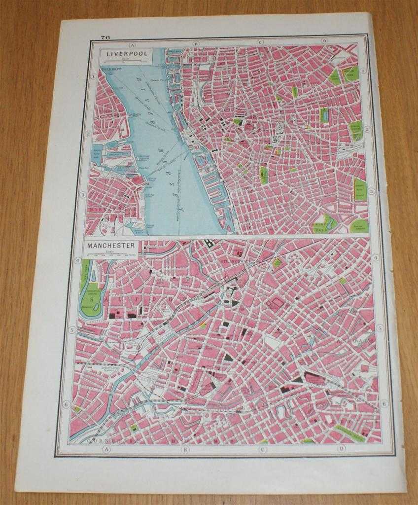
Description: The Educational Book Co. Ltd. London, 1922. Early Edition, Softcover. Very Good Condition/No Dust Jacket. Single disbound map page from Harmsworth's Atlas of the World and Pictorial Gazetteer. Single sheet only which is divided into 2 panels, plans are in colour and sheet is suitable for framing. Page size is approximately 37 x 24.5cm, actual printed area is approximately 32.5 x 21.5cm. Sheet is clean and bright. Two panels contain street plans for central parts of Liverpool (including Liver Building, St. George's Hall, Anglican Cathedral, Workhouse, Lime Street Station, Albert Dock, Wallasey Dock, etc.) and Manchester (including London Road, Central, Victoria and Exchange Stations, Corn Exchange, Cathedral, etc.). No dust jacket, as published. Undated by publisher. Single sheet map/chart which is suitable for framing . Dated by reference to COPAC/Library Hub Discover. Quantity Available: 1. Shipped Weight: under 1 kg. Pictures of this item not already displayed here available upon request. Inventory No: 45321024021. ISBN: 3572074428
Keywords: BZDB4 Maps; British History; Architecture; Lancashire. Edited by J. A. Hammerton; Miss H. B. Leach, H. W. Cribb and J. T. Rankin Street Plans of Liverpool and Manchester from Harmsworth's 1922 Atlas of the World - Single Sheet British History Architecture
See more books from our catalog: Maps
Title: Street Plans of Liverpool and Manchester from Harmsworth's 1922 Atlas of the World - Single Sheet
Description: The Educational Book Co. Ltd. London, 1922. Early Edition, Softcover. Very Good Condition/No Dust Jacket. Single disbound map page from Harmsworth's Atlas of the World and Pictorial Gazetteer. Single sheet only which is divided into 2 panels, plans are in colour and sheet is suitable for framing. Page size is approximately 37 x 24.5cm, actual printed area is approximately 32.5 x 21.5cm. Sheet is clean and bright. Two panels contain street plans for central parts of Liverpool (including Liver Building, St. George's Hall, Anglican Cathedral, Workhouse, Lime Street Station, Albert Dock, Wallasey Dock, etc.) and Manchester (including London Road, Central, Victoria and Exchange Stations, Corn Exchange, Cathedral, etc.). No dust jacket, as published. Undated by publisher. Single sheet map/chart which is suitable for framing . Dated by reference to COPAC/Library Hub Discover. Quantity Available: 1. Shipped Weight: under 1 kg. Pictures of this item not already displayed here available upon request. Inventory No: 45321024021. ISBN: 3572074428
Keywords: BZDB4 Maps; British History; Architecture; Lancashire. Edited by J. A. Hammerton; Miss H. B. Leach, H. W. Cribb and J. T. Rankin Street Plans of Liverpool and Manchester from Harmsworth's 1922 Atlas of the World - Single Sheet British History Architecture
Price: GBP 13.00 = appr. US$ 18.56 Seller: Bailgate Books Ltd
- Book number: 45321024021
- Book number: 45321024021
See more books from our catalog: Maps