Author: John Bartholomew & Co
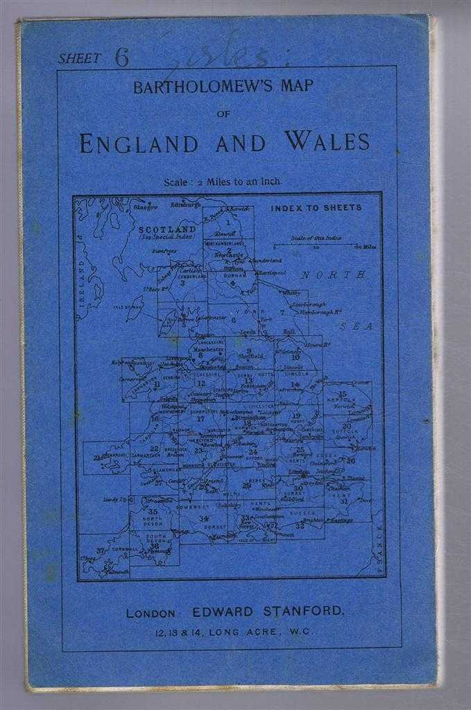
Title: Bartholomew's Map of England and Wales, Sheet 6, Leeds and Harrogate, dissected & mounted on linen - Bartholomew's "Half-Inch To Mile"
Description: Map John Bartholomew & Co, Duncan Street, Edinburgh, 1918. Edition Unstated, Soft cover. Very Good/No Dust Jacket. Undated by publisher. Scale; Two miles to an inch. Publisher's address given as Edward Stanford, Long Acre, London. No price shown for this map but catalogue for Stanford's Maps for Cycling & Motoring is shown for England and Wales as 2/6 and 3/-.. CTC logo (trimmed) on lower margin, Blue card covers, linen back, blue catalogue pasted on single panel on reverse of map. Roads are un-numbered, major roads are in red, some less major roads are in red and white, minor roads are uncoloured. Map is intact, clean and bright, reverse is also clean but has light foxing. Front cover has the sheet no. stamped on and "Yorks" handwritten. Area covered includes: Clitheroe, Burnley, Bradford, Leeds, York, Ampleforthe, Thirsk, Ripon, Harrogate, Middleham, Askrigg, Clapham, Settle, Skipton. Item Type: Map. Undated by publisher. Estimated date only. Quantity Available: 1. Shipped Weight: under 1 kg. Pictures of this item not already displayed here available upon request. Inventory No: 45116091129. ISBN: 0954124804
Keywords: BZDB4 Scotland, map Maps; British History; Yorkshire. John Bartholomew & Co Bartholomew's Map of England and Wales, Sheet 6, Leeds and Harrogate, dissected & mounted on linen - Bartholomew's "Half-Inch To Mile" British History Yorkshire
See more books from our catalog: Maps
Title: Bartholomew's Map of England and Wales, Sheet 6, Leeds and Harrogate, dissected & mounted on linen - Bartholomew's "Half-Inch To Mile"
Description: Map John Bartholomew & Co, Duncan Street, Edinburgh, 1918. Edition Unstated, Soft cover. Very Good/No Dust Jacket. Undated by publisher. Scale; Two miles to an inch. Publisher's address given as Edward Stanford, Long Acre, London. No price shown for this map but catalogue for Stanford's Maps for Cycling & Motoring is shown for England and Wales as 2/6 and 3/-.. CTC logo (trimmed) on lower margin, Blue card covers, linen back, blue catalogue pasted on single panel on reverse of map. Roads are un-numbered, major roads are in red, some less major roads are in red and white, minor roads are uncoloured. Map is intact, clean and bright, reverse is also clean but has light foxing. Front cover has the sheet no. stamped on and "Yorks" handwritten. Area covered includes: Clitheroe, Burnley, Bradford, Leeds, York, Ampleforthe, Thirsk, Ripon, Harrogate, Middleham, Askrigg, Clapham, Settle, Skipton. Item Type: Map. Undated by publisher. Estimated date only. Quantity Available: 1. Shipped Weight: under 1 kg. Pictures of this item not already displayed here available upon request. Inventory No: 45116091129. ISBN: 0954124804
Keywords: BZDB4 Scotland, map Maps; British History; Yorkshire. John Bartholomew & Co Bartholomew's Map of England and Wales, Sheet 6, Leeds and Harrogate, dissected & mounted on linen - Bartholomew's "Half-Inch To Mile" British History Yorkshire
Price: GBP 12.00 = appr. US$ 17.14 Seller: Bailgate Books Ltd
- Book number: 45116091129
- Book number: 45116091129
See more books from our catalog: Maps