Author: Edward Stanford, T. Hewett Key, J. & C. Walker
Title: Map of France in Provinces - disbound sheet from 1857 "University Atlas"
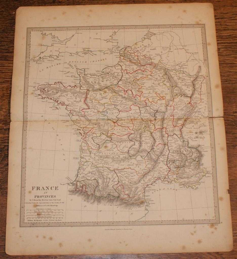
Description: Edward Stanford, London, 1857. First Edition, Softcover. Good Condition/No Dust Jacket. Disbound single Sheet Map with horizontal centre fold from "The University Atlas of Classical and Modern Geography, including all the Recent Geographical Discoveries". Sheet is a little foxed and marked with slightly darkened edges. Some wear and minor damage to edges and corners. Fold is split at both ends and a little fragile. Map covers the whole of France which is divided into Provinces. Provinces are outlined in various bright colours and coast lines in very pale blue. Quantity Available: 1. Shipped Weight: under 1 kg. Pictures of this item not already displayed here available upon request. Inventory No: 45019044026. ISBN: 1873078005
Keywords: BZDB4 Maps; 18th & 19th century non-fiction; European History; France and French Language. Edward Stanford, T. Hewett Key, J. & C. Walker Map of France in Provinces - disbound sheet from 1857 "University Atlas" 18th & 19th century non-fiction European His
See more books from our catalog: Maps
Title: Map of France in Provinces - disbound sheet from 1857 "University Atlas"
Description: Edward Stanford, London, 1857. First Edition, Softcover. Good Condition/No Dust Jacket. Disbound single Sheet Map with horizontal centre fold from "The University Atlas of Classical and Modern Geography, including all the Recent Geographical Discoveries". Sheet is a little foxed and marked with slightly darkened edges. Some wear and minor damage to edges and corners. Fold is split at both ends and a little fragile. Map covers the whole of France which is divided into Provinces. Provinces are outlined in various bright colours and coast lines in very pale blue. Quantity Available: 1. Shipped Weight: under 1 kg. Pictures of this item not already displayed here available upon request. Inventory No: 45019044026. ISBN: 1873078005
Keywords: BZDB4 Maps; 18th & 19th century non-fiction; European History; France and French Language. Edward Stanford, T. Hewett Key, J. & C. Walker Map of France in Provinces - disbound sheet from 1857 "University Atlas" 18th & 19th century non-fiction European His
Price: GBP 26.00 = appr. US$ 37.13 Seller: Bailgate Books Ltd
- Book number: 45019044026
- Book number: 45019044026
See more books from our catalog: Maps