Author: Edward Stanford, J. & C. Walker
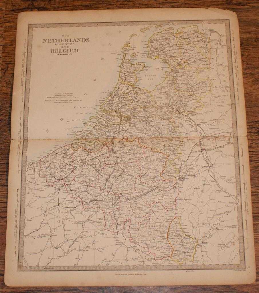
Title: Map of the Netherlands and Belguim (De Nederlanden & La Belgique) - disbound sheet from 1857 "University Atlas"
Description: Edward Stanford, London, 1857. First Edition, Softcover. Good Condition/No Dust Jacket. Disbound single Sheet Map with horizontal centre fold from "The University Atlas of Classical and Modern Geography, including all the Recent Geographical Discoveries". Sheet is a little foxed with slightly darkened edges. Some wear and minor damage to edges and corners. Fold is split at both ends and a little fragile. The Netherlands are delineated in yellow and Belgium in Pink, boundaries mark both the Kingdoms and the Principalities. Parts of boardering France, Hannover and Prussia are present. Coast with North Sea is marked in pale blue. Quantity Available: 1. Shipped Weight: under 1 kg. Pictures of this item not already displayed here available upon request. Inventory No: 45019044024. ISBN: 1873078005
Keywords: BZDB4 Maps; 18th & 19th century non-fiction; British History; Scotland. Edward Stanford, J. & C. Walker Map of the Netherlands and Belguim (De Nederlanden & La Belgique) - disbound sheet from 1857 "University Atlas" 18th & 19th century non-fiction British
See more books from our catalog: Maps
Title: Map of the Netherlands and Belguim (De Nederlanden & La Belgique) - disbound sheet from 1857 "University Atlas"
Description: Edward Stanford, London, 1857. First Edition, Softcover. Good Condition/No Dust Jacket. Disbound single Sheet Map with horizontal centre fold from "The University Atlas of Classical and Modern Geography, including all the Recent Geographical Discoveries". Sheet is a little foxed with slightly darkened edges. Some wear and minor damage to edges and corners. Fold is split at both ends and a little fragile. The Netherlands are delineated in yellow and Belgium in Pink, boundaries mark both the Kingdoms and the Principalities. Parts of boardering France, Hannover and Prussia are present. Coast with North Sea is marked in pale blue. Quantity Available: 1. Shipped Weight: under 1 kg. Pictures of this item not already displayed here available upon request. Inventory No: 45019044024. ISBN: 1873078005
Keywords: BZDB4 Maps; 18th & 19th century non-fiction; British History; Scotland. Edward Stanford, J. & C. Walker Map of the Netherlands and Belguim (De Nederlanden & La Belgique) - disbound sheet from 1857 "University Atlas" 18th & 19th century non-fiction British
Price: GBP 26.00 = appr. US$ 37.13 Seller: Bailgate Books Ltd
- Book number: 45019044024
- Book number: 45019044024
See more books from our catalog: Maps