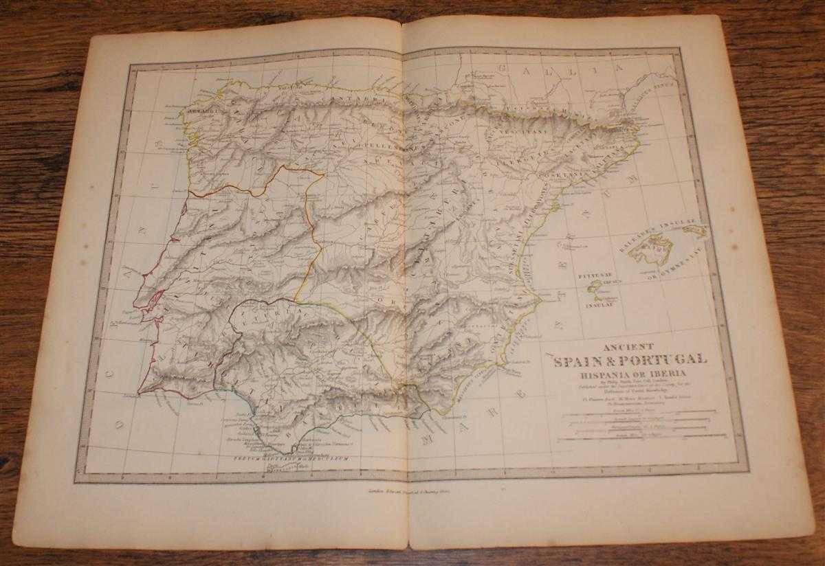
Author: Edward Stanford, Drawn by Rev. Philip Smith
Title: Map of Ancient Spain & Portugal (Hispania or Iberia) - disbound sheet from 1857 "University Atlas"
Description: Edward Stanford, London, 1857. First Edition, Softcover. Good Condition/No Dust Jacket. Disbound single Sheet Map with vertical centre fold from "The University Atlas of Classical and Modern Geography, including all the Recent Geographical Discoveries". Sheet is very lightly foxed with slightly darkened edges. Some wear and minor damage to edges and corners. Fold is slightly split at both ends and a little fragile. Area covered includes: Tarraconesis, Lusitania, Baetica, Baleares Insulaae or Gymnesiae, Pityusae Insulae, etc. Quantity Available: 1. Shipped Weight: under 1 kg. Pictures of this item not already displayed here available upon request. Inventory No: 45019044005. ISBN: 1873078005
Keywords: BZDB4 Maps; Spain and Portugal, Spanish & Portuguese Language; European History; Early History. Edward Stanford, Drawn by Rev. Philip Smith Map of Ancient Spain & Portugal (Hispania or Iberia) - disbound sheet from 1857 "University Atlas" Spain and Portug
See more books from our catalog: Maps
Title: Map of Ancient Spain & Portugal (Hispania or Iberia) - disbound sheet from 1857 "University Atlas"
Description: Edward Stanford, London, 1857. First Edition, Softcover. Good Condition/No Dust Jacket. Disbound single Sheet Map with vertical centre fold from "The University Atlas of Classical and Modern Geography, including all the Recent Geographical Discoveries". Sheet is very lightly foxed with slightly darkened edges. Some wear and minor damage to edges and corners. Fold is slightly split at both ends and a little fragile. Area covered includes: Tarraconesis, Lusitania, Baetica, Baleares Insulaae or Gymnesiae, Pityusae Insulae, etc. Quantity Available: 1. Shipped Weight: under 1 kg. Pictures of this item not already displayed here available upon request. Inventory No: 45019044005. ISBN: 1873078005
Keywords: BZDB4 Maps; Spain and Portugal, Spanish & Portuguese Language; European History; Early History. Edward Stanford, Drawn by Rev. Philip Smith Map of Ancient Spain & Portugal (Hispania or Iberia) - disbound sheet from 1857 "University Atlas" Spain and Portug
Price: GBP 26.00 = appr. US$ 37.13 Seller: Bailgate Books Ltd
- Book number: 45019044005
- Book number: 45019044005
See more books from our catalog: Maps