Author: antique map (kaart).
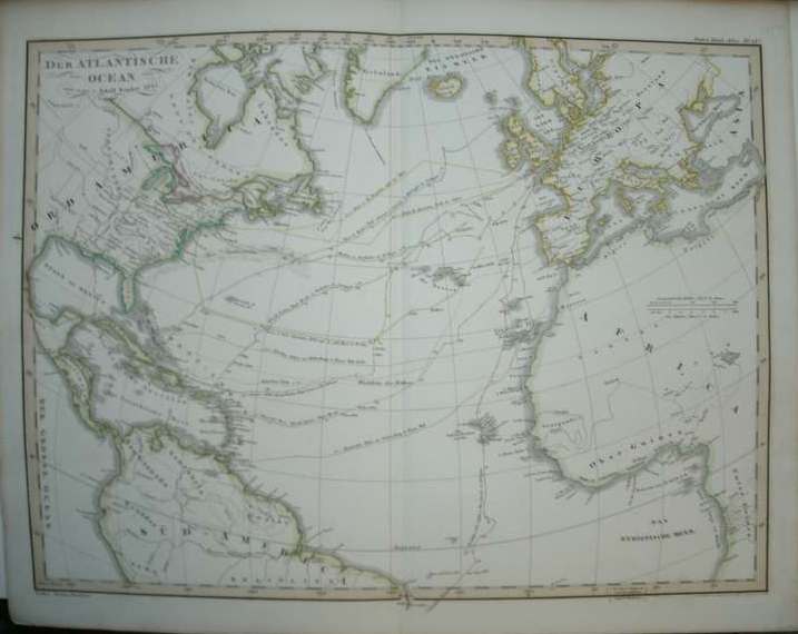
Title: Der Atlantische Ocean. (Antique map of the atlantic ocean).
Description: Gotha, Justus Perthes, 1851. Steelengraving by F. von Stulpnagel. Orig.coloured in outlines. From: Stieler's Hand-Atlas. Plate size ca.42x31.5 cm.
Keywords: cartografie topography topografie maps cartography grafiek graphic art
Price: EUR 100.00 = appr. US$ 108.68 Seller: Antiquariaat Victory
- Book number: 17831
- Book number: 17831