Author: Anonymous
Title: Ecclesiastical Map of the South of England
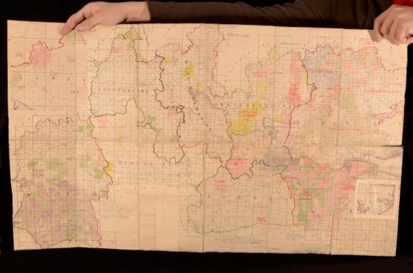
Description: Kent , Publisher Unknown, c1920. Cloth. A hand assembled map of the counties of the south of England showing Church of England administrative areas. With ink annotations from a previous owner, and some hand-colouring to the counties. Covering Wiltshire, Dorset, Oxfordshire, Berkshire, Buckinghamshire, Herfordshire, Middlesex, Surrey, Essex and Kent. Ink stamp and bookplate of Arthur Campling, Kent to rear of map. In a blue cloth binding with handwritten label. Externally, smart, with just a few marks. Internally, the map has additional counties pasted to the main map, along with annotations and old ink spills. Good . Ill.: None. Good .
Keywords: Church of England England Folding Map South of England England None
See more books from our catalog: Atlases
Title: Ecclesiastical Map of the South of England
Description: Kent , Publisher Unknown, c1920. Cloth. A hand assembled map of the counties of the south of England showing Church of England administrative areas. With ink annotations from a previous owner, and some hand-colouring to the counties. Covering Wiltshire, Dorset, Oxfordshire, Berkshire, Buckinghamshire, Herfordshire, Middlesex, Surrey, Essex and Kent. Ink stamp and bookplate of Arthur Campling, Kent to rear of map. In a blue cloth binding with handwritten label. Externally, smart, with just a few marks. Internally, the map has additional counties pasted to the main map, along with annotations and old ink spills. Good . Ill.: None. Good .
Keywords: Church of England England Folding Map South of England England None
Price: GBP 49.99 = appr. US$ 71.38 Seller: Rooke Books
- Book number: GEN19-I-3
- Book number: GEN19-I-3
See more books from our catalog: Atlases