Author: John Betjeman
Title: Historic Buildings of North Wales: A Map & Guide Illustrating 400 Buildings
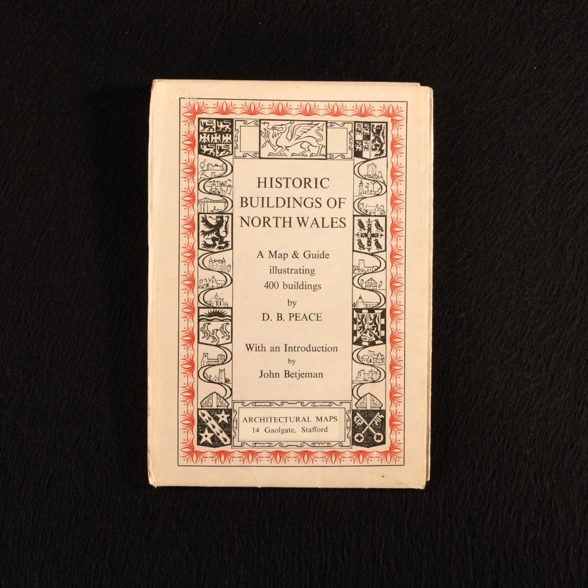
Description: Stafford, Architectural Maps , 1958. First edition. Paperback. The first edition of this very scarce and beautifully illustrated large folding colour map depicting historic buildings of North Wales, by John Betjeman and D. B. Peace. The first edition. Illustrated by D. B. Peace. A large folding map with colour illustrations depicting historic buildings across North Wales. A very scarce work. This scarce folding map depicts the historic buildings of North Wales and was created by D. B. Peace with charming illustrations, and an introduction by John Betjeman. Betjeman, the noted poet, was well known for his passion for architecture and his work preserving and defending Victorian buildings. Large folding map. Very smart with only the odd very small chip to the extremities, and light handling marks. Very Good Indeed . Ill.: D. B. Peace. Very Good Indeed .
Keywords: Map Folding map Architecture John Betjeman Folding map D. B. Peace
See more books from our catalog: Travel & Exploration
Title: Historic Buildings of North Wales: A Map & Guide Illustrating 400 Buildings
Description: Stafford, Architectural Maps , 1958. First edition. Paperback. The first edition of this very scarce and beautifully illustrated large folding colour map depicting historic buildings of North Wales, by John Betjeman and D. B. Peace. The first edition. Illustrated by D. B. Peace. A large folding map with colour illustrations depicting historic buildings across North Wales. A very scarce work. This scarce folding map depicts the historic buildings of North Wales and was created by D. B. Peace with charming illustrations, and an introduction by John Betjeman. Betjeman, the noted poet, was well known for his passion for architecture and his work preserving and defending Victorian buildings. Large folding map. Very smart with only the odd very small chip to the extremities, and light handling marks. Very Good Indeed . Ill.: D. B. Peace. Very Good Indeed .
Keywords: Map Folding map Architecture John Betjeman Folding map D. B. Peace
Price: GBP 60.00 = appr. US$ 85.68 Seller: Rooke Books
- Book number: 938Z9
- Book number: 938Z9
See more books from our catalog: Travel & Exploration