Author: John Cary
Title: A New Map of Northumberland, Divided Into Wards; Exhibiting the Whole of the Turnpike and Cross Roads, the Course of the Rivers, Market and Borough Towns, Parishes, Hamlets, Parks, &C.
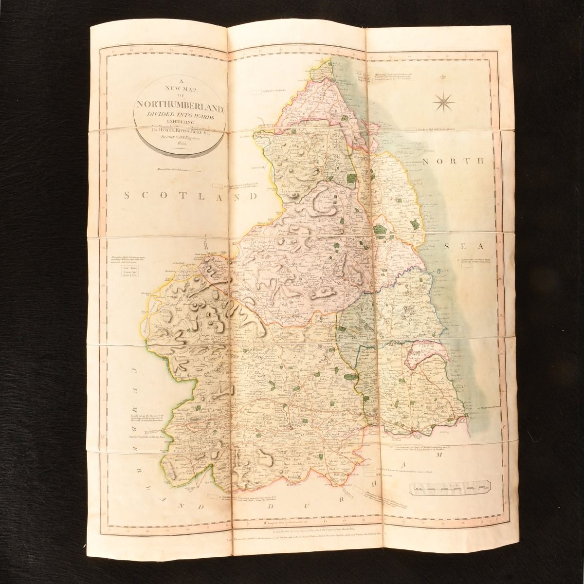
Description: London, G. and J. Cary, 1824 . First edition. Paperback. A very scarce, bright copy of Cary's new map of Northumberland, encased in a slip case. The map is bright, with colour ink, measuring at 23.5" by 14.5". Encased in a slip case. Comprised of a map of Northumberland by prominent English cartographer, John Cary, who had a great reputation for his maps, globes and atlases during his life. Cary was commissioned to survey the roads of England, leading to new versions of his maps being created. This particular map is divided into wards, exhibiting the whole of the turnpike and crossroads, the course of the rivers, the market and borough towns, the parishes, hamlets and parks of the area.A Wales & Co Stationers, Printers and Mapsellers stamp to the front of the slip case. Externally, smart, with light rubbing to the slip case extremities and light soiling to the front. The odd mark to the slip case. The map is bright with light handling marks and very light spotting, mainly to the reverse. Very Good Indeed . Ill.: Not Stated. Very Good Indeed .
Keywords: map northumberland first edition new map northumberland scarce Not Stated
See more books from our catalog: British History
Title: A New Map of Northumberland, Divided Into Wards; Exhibiting the Whole of the Turnpike and Cross Roads, the Course of the Rivers, Market and Borough Towns, Parishes, Hamlets, Parks, &C.
Description: London, G. and J. Cary, 1824 . First edition. Paperback. A very scarce, bright copy of Cary's new map of Northumberland, encased in a slip case. The map is bright, with colour ink, measuring at 23.5" by 14.5". Encased in a slip case. Comprised of a map of Northumberland by prominent English cartographer, John Cary, who had a great reputation for his maps, globes and atlases during his life. Cary was commissioned to survey the roads of England, leading to new versions of his maps being created. This particular map is divided into wards, exhibiting the whole of the turnpike and crossroads, the course of the rivers, the market and borough towns, the parishes, hamlets and parks of the area.A Wales & Co Stationers, Printers and Mapsellers stamp to the front of the slip case. Externally, smart, with light rubbing to the slip case extremities and light soiling to the front. The odd mark to the slip case. The map is bright with light handling marks and very light spotting, mainly to the reverse. Very Good Indeed . Ill.: Not Stated. Very Good Indeed .
Keywords: map northumberland first edition new map northumberland scarce Not Stated
Price: GBP 145.00 = appr. US$ 207.06 Seller: Rooke Books
- Book number: 890Q11
- Book number: 890Q11
See more books from our catalog: British History