Author: Walter Besant
Title: The Survey of London
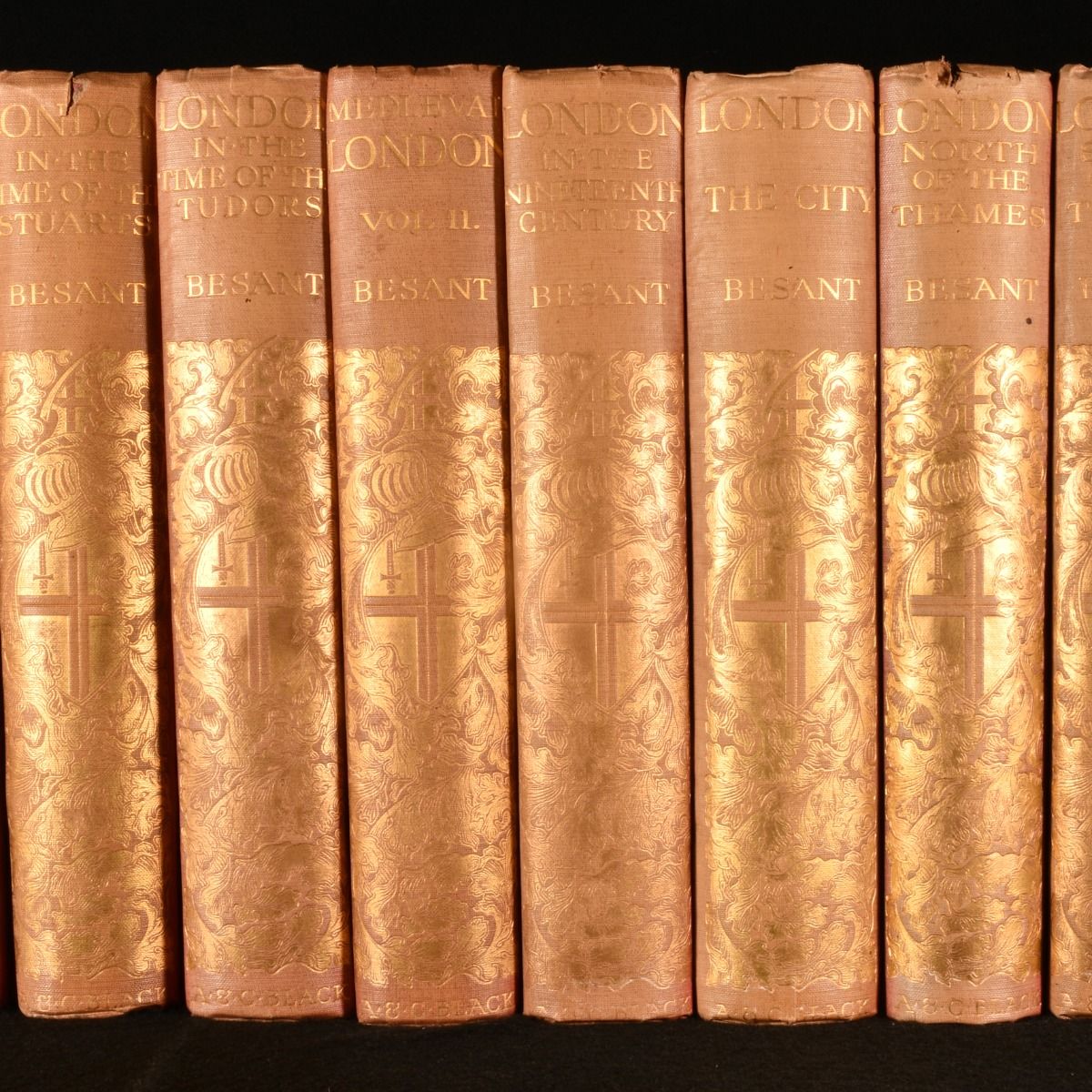
Description: London, A. & C. Black, 1902-12. First edition. Cloth. The first editions of these eight volumes by Walter Besant, exploring the historical topography of London, illustrated beautifully throughout with plates and folding maps. The first edition of these works.Walter Besant's extensive study of historical London, a wonderful and expansive history across eight volumes. These form part of his 'Survey of London' series, each volume looking at the city in a different era of its rich history.Besant was a noted Victorian novelist and historian, writing extensively on London topography.'London in the Eighteenth Century', published in 1902, illustrated with a frontispiece, one folding map, twenty-one plates, and in-text illustrations. Collated, complete. 'London in the Time of the Stuarts', published in 1903, illustrated with a frontispiece, one folding map, two double-paged plates, thirteen plates, and in-text illustrations. Collated, complete. 'London in the Time of the Tudors', published in 1904, illustrated with a frontispiece, one folding map, five double-paged plates, thirteen plates, and in-text illustrations. Collated, complete.'Mediaeval London' Part II, Ecclesiastical, published in 1906, illustrated with one double-paged map, eight plates, and in-text illustrations. Collated, complete.'London in the Nineteenth Century', published in 1909, illustrated with a frontispiece, one folding map, twenty-six plates, and in-text illustrations. Two pages of adverts to the rear. Collated, complete.'London City', published in 1910, illustrated with a frontispiece, one folding map, fifteen plates, and in-text illustrations. Collated, complete.'London North of the Thames', published in 1911, illustrated with a frontispiece, one folding map, seven plates, and in-text illustrations. Collated, complete.'London South of the Thames', published in 1912, illustrated with a frontispiece, one folding map, two double-paged maps, fifteen plates, and in-text illustrations. Collated, complete. In the original publisher's cloth binding. Externally, generally smart. A few minor marks to the boards and spine. Spines are a little faded. Bumping to the spines and extremities, a little heavier to the head of the spine of 'London North of the Thames&apos. Small chip to the head of the spine of 'London in the Time of the Stuarts&apos. Fading to the front board of 'London South of the Thames&apos. Rear hinge of 'London City' is starting but firm. Prior owner's ink inscription to the front paste downs. Internally, firmly bound. Pages are bright and generally clean with some odd spots. Folding plate have tape repairs to the reverse. Very Good . Ill.: Various. Very Good .
Keywords: The Survey of London london topography history london thames medieval Various
See more books from our catalog: Travel & Exploration
Title: The Survey of London
Description: London, A. & C. Black, 1902-12. First edition. Cloth. The first editions of these eight volumes by Walter Besant, exploring the historical topography of London, illustrated beautifully throughout with plates and folding maps. The first edition of these works.Walter Besant's extensive study of historical London, a wonderful and expansive history across eight volumes. These form part of his 'Survey of London' series, each volume looking at the city in a different era of its rich history.Besant was a noted Victorian novelist and historian, writing extensively on London topography.'London in the Eighteenth Century', published in 1902, illustrated with a frontispiece, one folding map, twenty-one plates, and in-text illustrations. Collated, complete. 'London in the Time of the Stuarts', published in 1903, illustrated with a frontispiece, one folding map, two double-paged plates, thirteen plates, and in-text illustrations. Collated, complete. 'London in the Time of the Tudors', published in 1904, illustrated with a frontispiece, one folding map, five double-paged plates, thirteen plates, and in-text illustrations. Collated, complete.'Mediaeval London' Part II, Ecclesiastical, published in 1906, illustrated with one double-paged map, eight plates, and in-text illustrations. Collated, complete.'London in the Nineteenth Century', published in 1909, illustrated with a frontispiece, one folding map, twenty-six plates, and in-text illustrations. Two pages of adverts to the rear. Collated, complete.'London City', published in 1910, illustrated with a frontispiece, one folding map, fifteen plates, and in-text illustrations. Collated, complete.'London North of the Thames', published in 1911, illustrated with a frontispiece, one folding map, seven plates, and in-text illustrations. Collated, complete.'London South of the Thames', published in 1912, illustrated with a frontispiece, one folding map, two double-paged maps, fifteen plates, and in-text illustrations. Collated, complete. In the original publisher's cloth binding. Externally, generally smart. A few minor marks to the boards and spine. Spines are a little faded. Bumping to the spines and extremities, a little heavier to the head of the spine of 'London North of the Thames&apos. Small chip to the head of the spine of 'London in the Time of the Stuarts&apos. Fading to the front board of 'London South of the Thames&apos. Rear hinge of 'London City' is starting but firm. Prior owner's ink inscription to the front paste downs. Internally, firmly bound. Pages are bright and generally clean with some odd spots. Folding plate have tape repairs to the reverse. Very Good . Ill.: Various. Very Good .
Keywords: The Survey of London london topography history london thames medieval Various
Price: GBP 400.00 = appr. US$ 571.19 Seller: Rooke Books
- Book number: 776P2
- Book number: 776P2
See more books from our catalog: Travel & Exploration