Author: Wit-- Frederick de (1630-1706)
Title: Tartary, China, Japan - De Wit, 1680
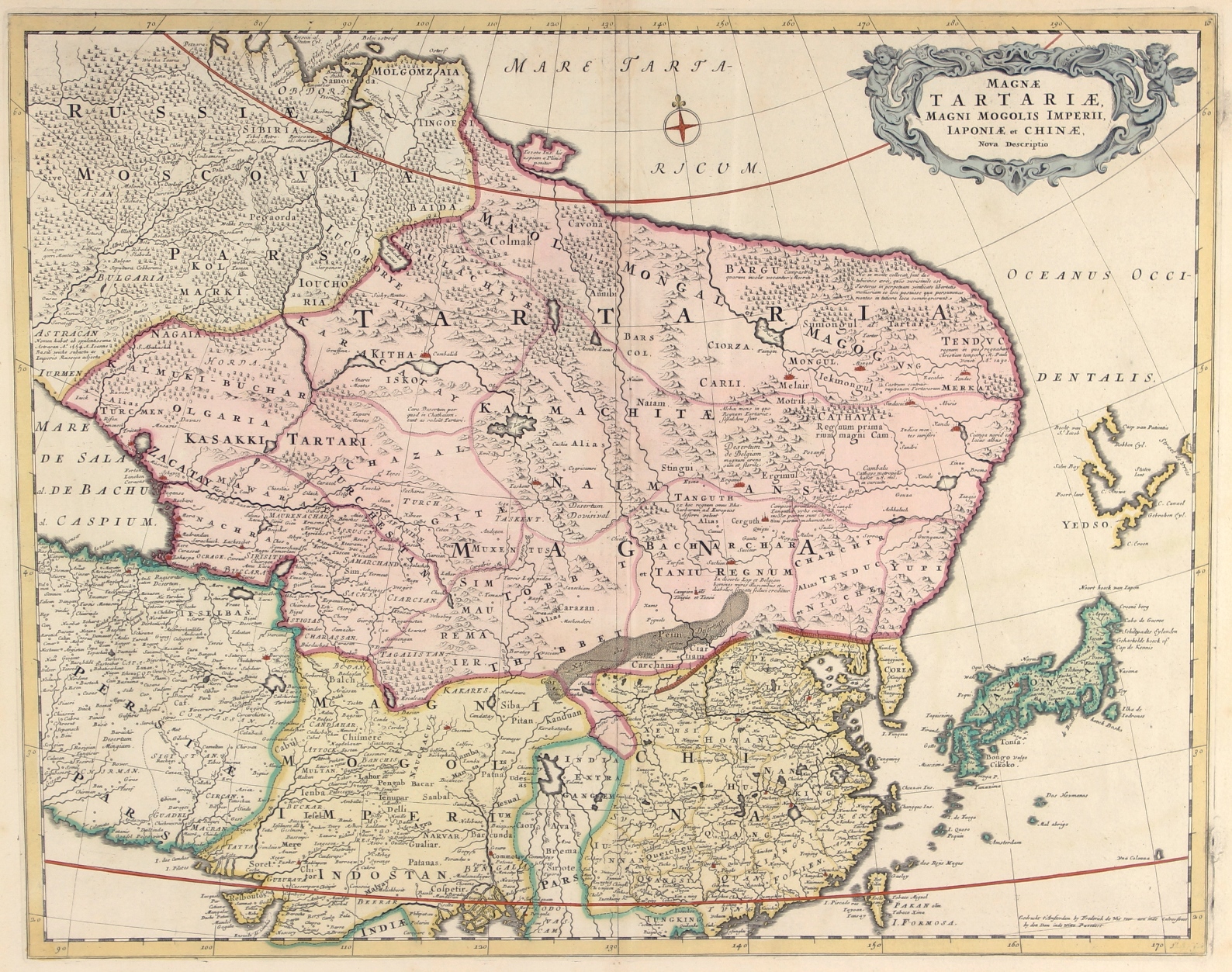
Description: Magnae Tartariae Magni Mogolis Imperii Iaponiae et Chinae Nova Descriptio. Copper engraving published 1680 by Frederick de Wit in Amsterdam. Original hand colouring. Size: 44 x 55 cm. Map of Northeastern Asia, extending from the Island of Formosa, the Ganges and the eastern part of the Caspian Sea to Yedso (the island of Hokkaido), Tartary, Siberia and Molgomzaia in Russian Asia in the North. No western exploration has yet reached Asia's northeast coast, and we see a conjectural rounded coastline. Plinius' Tazata Island appears north of the Arctic Circle, and a sense of Tartary's mountain ranges is given, but the topography is by no means accurate. There is geographical and historical commentary throughout Tartary. The Great Wall is shown pictorially, and many cities are named in China and northern India. The fictional Lake Chiang Mai is still shown as the source of the great rivers of Southeast Asia. Yedso (Hokkaido) is shown in a very limited way, with partial coastlines. A very interesting map, from a period when Europe's knowledge of China has greatly improved, but the depiction of northern and central Asia remains largely speculative. Decorated with finely engraved mountains and trees. Price: Euro 475,-
Keywords: Wit-- Frederick de (1630-1706)
Title: Tartary, China, Japan - De Wit, 1680
Description: Magnae Tartariae Magni Mogolis Imperii Iaponiae et Chinae Nova Descriptio. Copper engraving published 1680 by Frederick de Wit in Amsterdam. Original hand colouring. Size: 44 x 55 cm. Map of Northeastern Asia, extending from the Island of Formosa, the Ganges and the eastern part of the Caspian Sea to Yedso (the island of Hokkaido), Tartary, Siberia and Molgomzaia in Russian Asia in the North. No western exploration has yet reached Asia's northeast coast, and we see a conjectural rounded coastline. Plinius' Tazata Island appears north of the Arctic Circle, and a sense of Tartary's mountain ranges is given, but the topography is by no means accurate. There is geographical and historical commentary throughout Tartary. The Great Wall is shown pictorially, and many cities are named in China and northern India. The fictional Lake Chiang Mai is still shown as the source of the great rivers of Southeast Asia. Yedso (Hokkaido) is shown in a very limited way, with partial coastlines. A very interesting map, from a period when Europe's knowledge of China has greatly improved, but the depiction of northern and central Asia remains largely speculative. Decorated with finely engraved mountains and trees. Price: Euro 475,-
Keywords: Wit-- Frederick de (1630-1706)
Price: EUR 475.00 = appr. US$ 516.25 Seller: Inter-Antiquariaat Mefferdt & De Jonge
- Book number: 831
- Book number: 831