Author: (NOVA SCOTIA -- NEW BRUNSWICK -- CAPE BRETON -- PRINCE EDWARD'S ISLAND -- Map)
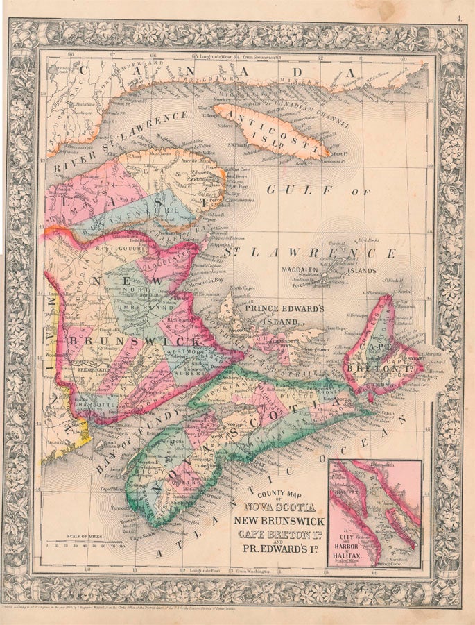
Title: County Map of Nova Scotia New Brunswick Cape Breton Id. And Pr. Edward's Id
Description: New York, S. Augustus Mitchell, Jr. 1860. Folio (12¼" X 15¼", image area 10½" X 13½"). Hand colored. Very good. Slightly age toned, with mild soiling (mainly about edges). A nice example of this well-colored multi-province Canadian map, from the 1864 edition of "Mitchell's New General Atlas, Containing Maps of the Various Countries of the World, Plans of Cities, Etc." Small vignette map at lower right depicts "City and Harbor of Halifax. .
Keywords:
See more books from our catalog: Maps
Title: County Map of Nova Scotia New Brunswick Cape Breton Id. And Pr. Edward's Id
Description: New York, S. Augustus Mitchell, Jr. 1860. Folio (12¼" X 15¼", image area 10½" X 13½"). Hand colored. Very good. Slightly age toned, with mild soiling (mainly about edges). A nice example of this well-colored multi-province Canadian map, from the 1864 edition of "Mitchell's New General Atlas, Containing Maps of the Various Countries of the World, Plans of Cities, Etc." Small vignette map at lower right depicts "City and Harbor of Halifax. .
Keywords:
Price: US$ 80.00 Seller: Main Street Fine Books & Manuscripts
- Book number: 47008
- Book number: 47008
See more books from our catalog: Maps