Author: Rand McNally & Co.
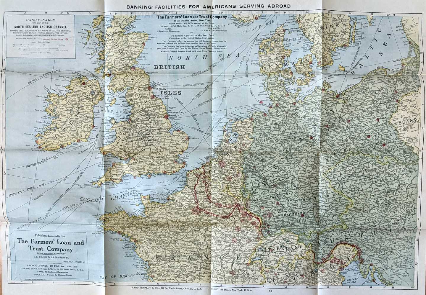
Title: Rand McNally War Map of the North Sea and English Channel
Description: Rand McNally & Co. Chicago and New York, No date. Softcover. Near Fine Condition. 58.5cm x 81cm. Folding colour map. Showing the Geographical Relations of all the Principal Ports of Great Britain, France, Belgium, the Netherlands, Denmark, Norway, Sweden and Germany. Published Especially for The Farmer's Loan and Trust Company, New York. Rand McNally would produce these maps as promotional items for business, banks, insurance brokers, etc. Minor tanning. Very minor holes at some centre folds. Shipped Weight: .03 kilos.
Keywords: BZDB407 Geography & Maps; Countries::North America::United States; Unbranded Rand McNally & Co. Rand McNally War Map of the North Sea and English Channel Countries::North America::United States
See more books from our catalog: Geography & Maps
Title: Rand McNally War Map of the North Sea and English Channel
Description: Rand McNally & Co. Chicago and New York, No date. Softcover. Near Fine Condition. 58.5cm x 81cm. Folding colour map. Showing the Geographical Relations of all the Principal Ports of Great Britain, France, Belgium, the Netherlands, Denmark, Norway, Sweden and Germany. Published Especially for The Farmer's Loan and Trust Company, New York. Rand McNally would produce these maps as promotional items for business, banks, insurance brokers, etc. Minor tanning. Very minor holes at some centre folds. Shipped Weight: .03 kilos.
Keywords: BZDB407 Geography & Maps; Countries::North America::United States; Unbranded Rand McNally & Co. Rand McNally War Map of the North Sea and English Channel Countries::North America::United States
Price: AUD 55.50 = appr. US$ 38.40 Seller: Book Merchant Jenkins
- Book number: 0031481
- Book number: 0031481
See more books from our catalog: Geography & Maps