Author: COAST AND GEODETIC SURVEY
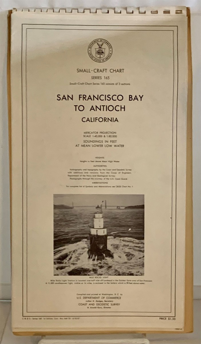
Title: San Francisco Bay to Antioch California Small-Craft Chart
Description: Washington, D. C.: U. S. Department of Commerce, 1961. 1st Edition; 1st Printing. Maps. This is a thin, oversized paperback book with a spiral binding at the top edge, and illustrated cardstock covers. The paperback is in Very Good- condition. The spiral binding has several spirals missing and the covers have a ripple by the top edge. There are three maps inside, and all three of the maps are in clean, bright condition. "In addition to water depths including the shoreline charts show the location of rocks, reefs, wrecks and other submerged obstructions, anchorages, channels, lighthouses, buoys, and even tide rips. The symbols and abbreviations for these features are often obvious but sometimes less so. All are illustrated and explained in NOS Chart No. 1: Symbols, Abbreviations and Terms, which isn't a chart at all, but a booklet. It used to cost about two bucks from the government, but today a hard copy, available only from a commercial vendor, will set you back about $10. Or you can download an electronic copy to your computer for free from NOAA. Either way, reading through Chart No. 1 will reveal new and useful details that charts often include." (from BoatUS). Very Good- .
Keywords: Ships & Sailing Coast And Geodetic Survey U. S. Deparment Of Commerce Small-craft San Francisco Bay Area Small Craft Charts Costal Surveys Boating
See more books from our catalog: Ships & Sailing
Title: San Francisco Bay to Antioch California Small-Craft Chart
Description: Washington, D. C.: U. S. Department of Commerce, 1961. 1st Edition; 1st Printing. Maps. This is a thin, oversized paperback book with a spiral binding at the top edge, and illustrated cardstock covers. The paperback is in Very Good- condition. The spiral binding has several spirals missing and the covers have a ripple by the top edge. There are three maps inside, and all three of the maps are in clean, bright condition. "In addition to water depths including the shoreline charts show the location of rocks, reefs, wrecks and other submerged obstructions, anchorages, channels, lighthouses, buoys, and even tide rips. The symbols and abbreviations for these features are often obvious but sometimes less so. All are illustrated and explained in NOS Chart No. 1: Symbols, Abbreviations and Terms, which isn't a chart at all, but a booklet. It used to cost about two bucks from the government, but today a hard copy, available only from a commercial vendor, will set you back about $10. Or you can download an electronic copy to your computer for free from NOAA. Either way, reading through Chart No. 1 will reveal new and useful details that charts often include." (from BoatUS). Very Good- .
Keywords: Ships & Sailing Coast And Geodetic Survey U. S. Deparment Of Commerce Small-craft San Francisco Bay Area Small Craft Charts Costal Surveys Boating
Price: US$ 30.00 Seller: S. Howlett-West Books
- Book number: 45104
- Book number: 45104
See more books from our catalog: Ships & Sailing