Author: U. S. GEOLOGICAL SURVEY
Title: Conventional Map Signs British and French January 1918
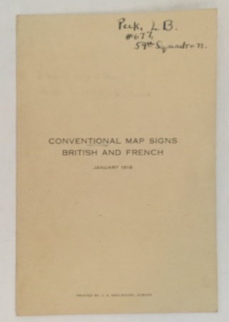
Description: Washington D. C.: U. S. Geological Survey, 1918. Other. B&W and Color Illustrations; This is one small sheet of cardstock, folded once vertically. The interior includes color and black and white illustrations of different marks used by the British (on the left side) and French (on the right) as part of their maps for World War I - possibly especially for trench warfare. The front of this item, with the title has some light, generalized toning and a previous owner's inked name and squadron (59th squadron) on the top edge. The interior is clean and bright. "Trench warfare prevailed on the Western Front from late 1914 until the Germans launched their Spring Offensive on 21 March 1918. After the buildup of forces in 1915, the Western Front became a stalemated struggle between equals, to be decided by attrition. Frontal assaults, and their associated casualties, became inevitable because the continuous trench lines had no open flanks. Casualties of the defenders matched those of the attackers, as vast reserves were expended in costly counter-attacks or exposed to the attacker's massed artillery. There were periods in which rigid trench warfare broke down, such as during the Battle of the Somme, but the lines never moved very far. The war would be won by the side that was able to commit the last reserves to the Western Front. ". Very Good+ .
Keywords: World War I U. S. Geological Survey Mapping Ephemera Trench Warfare Map Signs World war I
See more books from our catalog: World War I
Title: Conventional Map Signs British and French January 1918
Description: Washington D. C.: U. S. Geological Survey, 1918. Other. B&W and Color Illustrations; This is one small sheet of cardstock, folded once vertically. The interior includes color and black and white illustrations of different marks used by the British (on the left side) and French (on the right) as part of their maps for World War I - possibly especially for trench warfare. The front of this item, with the title has some light, generalized toning and a previous owner's inked name and squadron (59th squadron) on the top edge. The interior is clean and bright. "Trench warfare prevailed on the Western Front from late 1914 until the Germans launched their Spring Offensive on 21 March 1918. After the buildup of forces in 1915, the Western Front became a stalemated struggle between equals, to be decided by attrition. Frontal assaults, and their associated casualties, became inevitable because the continuous trench lines had no open flanks. Casualties of the defenders matched those of the attackers, as vast reserves were expended in costly counter-attacks or exposed to the attacker's massed artillery. There were periods in which rigid trench warfare broke down, such as during the Battle of the Somme, but the lines never moved very far. The war would be won by the side that was able to commit the last reserves to the Western Front. ". Very Good+ .
Keywords: World War I U. S. Geological Survey Mapping Ephemera Trench Warfare Map Signs World war I
Price: US$ 60.00 Seller: S. Howlett-West Books
- Book number: 38672
- Book number: 38672
See more books from our catalog: World War I