Author: WITKAMP, P.H.,
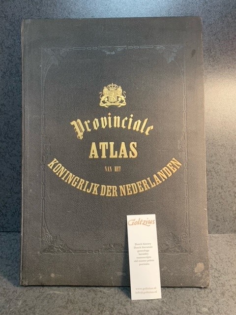
Title: Kaarten der provinciën van het Koningrijk der Nederlanden : vervaardigd naar de groote topographische en militaire kaart van het Ministerie van Oorlog en naar Schetsen der gemeenten door P.H. Witkamp / door J. Smulders & Co. ... ; met bijvoeging van uitvoerige statistieke opgave van P.H. Witkamp.
Description: 's Gravenhage, H. Bogaerts/J. Smulders & Co., [1866-67], largo folio: 51x37cm, based on the statistical information of Pieter Harmen Witkamp (1816-1892), 10 lithograph maps, handcoloured borders, coats of arms and other details, textpages describing the individual provinces, includes 'Alphabetische naamlijst der Nederlandsche gemeenten, met vermelding der bevolking op 1 januarij 1867. door P. H. Witkamp.', library stamp of Rijkskweekschool voor onderwijzers on titlepage. attractive tooled linen binding, gilt ornament (coat of arms) and lettering on front. Very good copy of this important atlas of the Netherlands.
Keywords:
See more books from our catalog: Topography
Title: Kaarten der provinciën van het Koningrijk der Nederlanden : vervaardigd naar de groote topographische en militaire kaart van het Ministerie van Oorlog en naar Schetsen der gemeenten door P.H. Witkamp / door J. Smulders & Co. ... ; met bijvoeging van uitvoerige statistieke opgave van P.H. Witkamp.
Description: 's Gravenhage, H. Bogaerts/J. Smulders & Co., [1866-67], largo folio: 51x37cm, based on the statistical information of Pieter Harmen Witkamp (1816-1892), 10 lithograph maps, handcoloured borders, coats of arms and other details, textpages describing the individual provinces, includes 'Alphabetische naamlijst der Nederlandsche gemeenten, met vermelding der bevolking op 1 januarij 1867. door P. H. Witkamp.', library stamp of Rijkskweekschool voor onderwijzers on titlepage. attractive tooled linen binding, gilt ornament (coat of arms) and lettering on front. Very good copy of this important atlas of the Netherlands.
Keywords:
Price: EUR 805.00 = appr. US$ 874.91 Seller: Antiquariaat Goltzius
- Book number: 69341
- Book number: 69341
See more books from our catalog: Topography