Author: (Besatzungskarte Deutschland und Österreich)
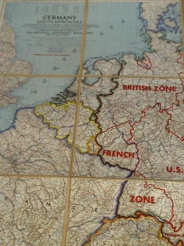
Title: Germany and its Approaches with International Boundaries as of September 1, 1939, the day Germany invaded Poland and, in red., Boundaries as of January 1, 1938, before Germany seized Austria and Czechoslovakia. Compiled and Drawn in the Cartographic Section of the National Geographic Society for The National Geographic Magazine, Gilbert Grosvenor, Editor - Scale 1:1.500.000 or 23.67 Miles to the Inch
Description: National Geographic Society, 1944. - sonst gutes Exemplar / good condition / Text englisch - Einband: Landkarten. 230
Keywords: Kartografie/ Karten
Price: EUR 90.00 = appr. US$ 97.82 Seller: Celler Versandantiquariat
- Book number: 5c3497
- Book number: 5c3497