Author: LANGREN, H. F. van.
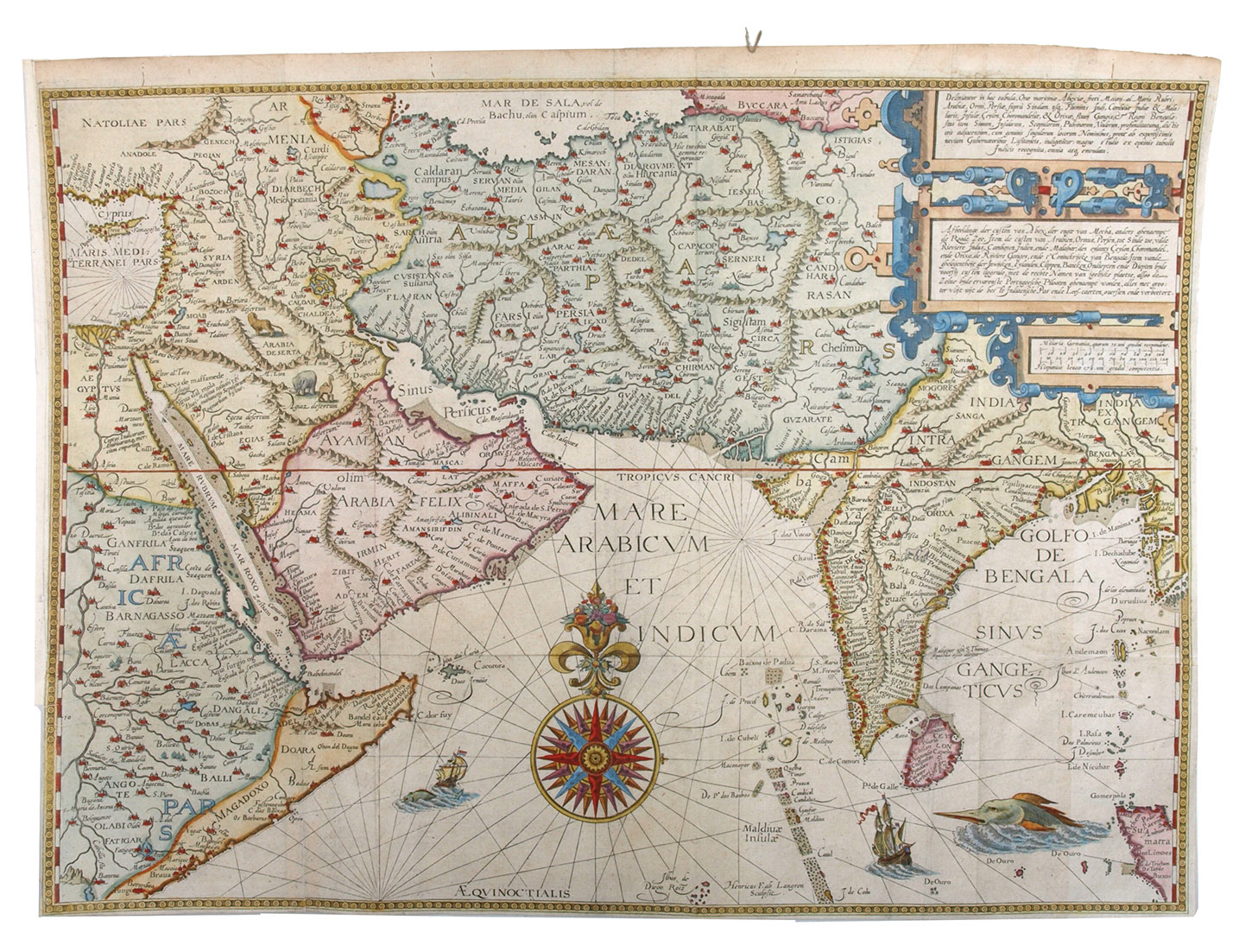
Title: Deliniantur in hac tabula, orae maritimae Abexiae, freti Mecani: al Maris Rubri-Arabiae ...Engraved map of Arabia, India and surroundings in 2 sheets (38.5 x 53.5 cm as assembled), engraved for J. Huygen van Linschoten, Itinerario, 1596). Matted.
Description: Famous map and nautical chart of the Arabian Sea and the Bay of Bengal, covering the regions from Cyprus and the Nile valley in the west to northern Sumatra and the Ganges valley in the east, including the entire Red Sea, the Gulf and part of the Caspian Sea, as well as the horn of Africa, the Middle East and what are now Sri Lanka, Iran and Afghanistan, all at a scale of about 1:13,000,000. It was engraved for Linschotens famous 1596 Itinerario and is taken from an unidentified edition sometime in the years 1596 to 1644. "Probably the first detailed navigation chart printed for the Indian Ocean and the Arabian sea" (Al Ankary 148). Though intended primarily as a nautical chart, with an elaborate compass rose, rhumb lines radiating from four points (including one in the Mediterranean) and numerous islands, coastal toponyms, sand bars, etc., but it also shows inland topographic features, including cities, mountains, lakes and rivers. Although it shows no parallels or meridians (aside from the Tropic of Cancer) the left and right borders include a reticulated scale of degrees latitude from the equator to more than 43°N, with the latitude noted every five degrees.l Al Ankary 148f; Clancy 70; Clancy/R. 67; Gole, Early maps 8; Schilder, MCN V, p. 140 & VII, p. 220/1; Tibbetts 46 (all illustrated).
Keywords: [9EE06DC76F16] ASIA|[9EE06DC76F16] ASIA -> [C4A78A11DA49] Cartography & Exploration|[9EE06DC76F16] ASIA -> [H9DK9EDSCHIJ] Central & West Asia|[9EE06DC76F16] ASIA -> [2E35157B4164] India & Sri Lanka|[80CBADC1D9E8] CARTOGRAPHY & EXPLORATION|[80CBADC1D9E8] C
Price: EUR 9500.00 = appr. US$ 10325.05 Seller: A. Asher & Co. B.V.
- Book number: JBDBMF1ENKK6
- Book number: JBDBMF1ENKK6