Author: USAF Aeronautical Chart and Information Service
Title: Map of Aguja Point, Ecuador-Peru
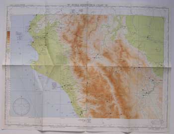
Description: Washington, D.C.: USAF Aeronautical Chart and Information Service, 1949. Color aeronautical chart measuring 28 x 22 inches. 3rd ed. April 1949. No. 1011. Scale = 1:1,000,000. Index, legend, etc. on verso. Folded. Ex-library with stamp but no other markings. .
Keywords:
See more books from our catalog: Ephemera
Title: Map of Aguja Point, Ecuador-Peru
Description: Washington, D.C.: USAF Aeronautical Chart and Information Service, 1949. Color aeronautical chart measuring 28 x 22 inches. 3rd ed. April 1949. No. 1011. Scale = 1:1,000,000. Index, legend, etc. on verso. Folded. Ex-library with stamp but no other markings. .
Keywords:
Price: US$ 75.00 Seller: Wittenborn Art Books
- Book number: 11-0737
- Book number: 11-0737
See more books from our catalog: Ephemera